Canada’s Great Trail app is better, but still sucks
I love the free maps.me app … but it’s lacking in North America as not many people use it here. It steered me wrong a number of times.
Google maps offline is not much help as it only shows automobile routes.
a British cyclist recommended the free ridewithgps app. I’ll try it next.
Canada’s Great Trail (formerly called the Trans Canada Trail) was better than I expected. B.C. includes many of the best sections.
I hiked less than anticipated
Sweet Creek Falls, Idaho
I had too much weight on the back. Next time I’ll use saddlebags mounted in front and (possibly) mid-frame
bikes need a lot of maintenance. And I’m the worst at bicycle maintenance. En route I fixed one flat. Had 4 broken spokes. Visited 4 bike shops. Had both tires upgraded.
Dave had his guys replace the chain and some other hardware. That helped immensely.
I started in Nanaimo wanting to get to Lake Cowichan as quickly as possible.
Lake Cowichan is the western terminus of the Great Trail.
Lake Cowichan to Victoria on the Cowichan Valley Trail
2. Islands to Port Townsend WA
After visiting friends in Victoria, I took the most direct route to visit friends in Port Townsend via the American San Juan Islands.
3. Port Townsend WA to Rattlesnake Lake WA
To avoid some highway miles, Doug & Diana delivered me to the Bainbridge ferry. I cycled the Burke-Gilman rail to trail and others connected to get to the fantastic Iron Horse Trail out of Rattlesnake Lake.
4. Rattlesnake Lake WA to Tekoa WA on the Palouse to Cascades State Park Trail
5. Eastern Washington
Just past Ellensburg I was forced off the semi-official GART on to secondary highways and alternative trails that took me through Spokane.
I found this section of GART to be too soft and sandy for my tires. Also it was too disconnected.
I finally stopped at Plummer, Idaho. Dave Adlard picked me up. We dropped the bike at a shop for repair as I’d broken 3 spokes the previous evening. And then took an indulgent 8 days off in Couer d’Alene.
6. North to Castlegar
Dave and Jeni rode with me away from the Adlard log cabin in Athol. We headed towards Sandpoint on back roads and I later rejoined the route shown in the map below. Dave had suggested I cross the border close to pretty Metaline Falls.
6. Castlegar to Hope
For decades I’d wanted to ride the Kettle Valley Rail (KVR) Trail and the Columbia & Western Rail Trail. It’s totally wonderful. And obviously one of the great cycling routes of the world.
Hope to Vancouver and on to Parksville on the Island was problematic. There is no excellent route yet available. Cyclists I met took a number of different roads.
Psychologically finished at Hope, I managed a series of rides, buses, trains and ferries to cover the 240km in about 36 hours without sleeping.
In the middle of the night — HOPE B.C. — I was awoken by rain.
Jumped out of the tent to put the fly which I’ve rarely used over the past month. The weather has been terrific.
It rained hard. The first hard rain of the month.
I packed up quickly in the morning when it let up briefly. But was soaked by the time I got to Tim Hortons and, later, McDonalds.
By about 9:30am the skies looked threatening … but I set out anyway with the vague dream of reaching Vancouver Island same day.
It looked unlikely as — shockingly — all these left coast Vancouver suburb cities have yet to organize a connected non-motorized trail through the big sleazy.
Least bad option was starting west on Laugheed Highway 7.
This was a big letdown after the Kettle Valley rail trail. 😕
Some of the bridges are quite dangerous for cyclists, as well.
Happily, the Golden Ears bridge (opened 2009) is a dream. It has bike-pedestrian protected lanes on each side.
On arrival in Langley I asked a bus driver the best public transit with bike to downtown Vancouver. That led to an intercity bus with bike rack. Cycling 6.5 km. The Sky Train. Ferry to Londsdale Quay. And two more local buses to Horseshoe Bay.
Click PLAY or watch it on YouTube.
And I made it to Horseshoe Bay in time for the 10:40pm last ferry. The last of the day.
Should I cross. Or wildcamp on the mainland?
I decided to take the ferry. It was 12:20am on arrival in Nanaimo.
Deciding not to wild camp, I decided to stay up all night in Tim Hortons and ride the final 30km or so at dawn.
Oops. Seems I ALSO accidentally turned off the Relive app after only 65km. The day was actually at least twice as long.
My navigation skills are poor. But in this case the confusion was mostly due to missing roads on the Maps.me app.
There was nobody to ask.
Also, there are very few road direction signs in this remote area.
Merde.
Another problem. One of my saddle bags broke. Luckily I’m a mechanical genius and quickly hacked a fix.
On the bright side I did see a LOT of wildlife this day. Fox. Coyote. Skunk. Marmot. My 5th bear.
Fewer cyclists cover this section. Some trail is in rough shape. Some rockslides never cleared.
The Great Trail gets complicated when it reaches the Coquihala highway.
All the cyclists I spoke with took the highway when they couldn’t find the trail. As I did.
The Coquihala wasn’t as bad as I feared. And as I was cycling downhill, my average speed was probably 30km / hour.
Happily, whomever added these white painted arrows did a good job. These pointed the best route.
One excellent section of the Great Trail required sliding the bike under these barriers.
There was some superb scenery on the way to Hope.
A British cyclist reminded me how lucky we were to have the chance to cycle in paradise.
Wondering about the time all day, I was happy to reach the Coquihalla Canyon Provincial Park before it closed at dark. Fantastic. And I’d never been before.
In the Coquihalla Gorge – the river cut a 300 foot deep channel of solid granite. A straight line of tunnels were built through it which are known now as the Othello Tunnels. …
This park highlights the Kettle Valley Railway grade that passes through the canyon and 5 tunnels which were built in 1914.
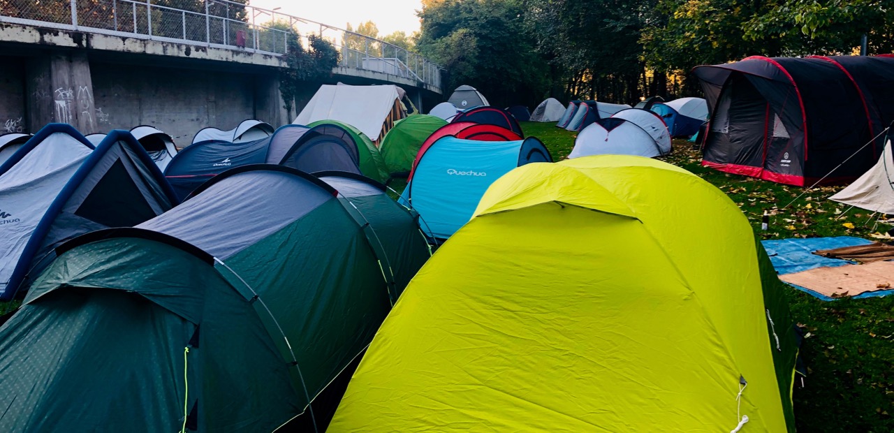
I wild camped close the very end of the 450 km Kettle Valley rail trail on the outskirts of Hope.
I wild camped here close to Penticton. Close to Tim Hortons.
I did a number of errands in Penticton but didn’t see many of the tourist attractions.
Two different cyclists told me the Kettle Valley rail trail from here to Summerland was closed. The Great Trail app told me to take the highway instead. That turned out to be the worst highway cycling so far. I wished I’d tried the old KVR route.
Summerland is gorgeous. I rode UPHILL through famed “Bottleneck drive“, a system of roads connecting wineries.
I was in great spirits cycling only 2% uphill grade on the KVR. Several sections were closed. People are forced to find detours.
This section had been covered by rock slide. I carried my bike and gear.
Over the past few days I’d been taking more frequent stops. That works for me. Less muscle cramping.
Stop and take photos of the picnic tables. 😀
I’m also leaving the KVR more often — taking roads instead as a break. The Summerland Princeton highway is near deserted.
Big snake. Over 2 foot long. And it’s not road kill. This one is alive.
Osprey Lake is the high point on the KVR too Princeton. It’s mostly downhill from here.
I decided to stop at Chain Lake campground. A pretty spot.
A fisherman who’d cycled the KVR years ago stopped by to gift me 2 home made cookies.
The past 2 nights had been surprisingly cold. The elevation, I’m assuming, as weather continues hot and clear.
This morning was tranquil.
McCulloch North Dam reservoir
There’s Kelowna far below.
I was second to arrive at the famous Myra Canyon Trestles, the best section of the Kettle Valley rail trail and — indeed — one of the highlights of Canada’s Great Trail.
18 wooden trestles and two tunnels!
People drive to one end or the other and rent bikes. They’ve had groups as large as 60 people!
This fire engulfed many portions of the KVR between Penticton and McCulloch Lake. After a valiant fight …, the fire unfortunately claimed 12 of the 18 trestles …
Restoration of the trail was completed, with an official re-opening ceremony held June 22, 2008. …
I took quite a bit of GoPro video which I won’t edit until end of trip.
I had been a bit disappointed in the amount of wildlife I’d seen so far. After 2 bears on day 1, I’d seen mostly deer and rabbits since.
But todayI saw two more bears. One still almost a cub. The other a BIG Black Bear. Both ran away so quickly I didn’t get photos.
The big one was on the trail between me and an oncoming German cyclist. He pulled out a whistle and reached for the Bear Spray mounted on his handlebars. This was only the 4th bear he’d ever seen. Big excitement.
Once past Myra the downhill into Penticton is mostly great riding.
I did take one shortcut trying to cut off about 6 miles. My road was probably tougher than sticking to the trail. AND I somehow broke another spoke.
While my spoke was being repaired in a bike shop I enjoyed a good break in town. Catching up on these trip reports, for example.
The only thing worse than explosive diarrhea is explosive diarrhea while cycling.
I hung out at the Grand Forks library, for example.
It was 1pm before I really got going on the rail trail.
Grand Forks
It is lovely country here close to the U.S. border.
Some sections allow motor vehicles. Too bad.
A tour of 5 of these vehicles passed me by.
At one point I was stopped by fire fighters. They were putting out a small blaze up high on a mountain. I watched the helicopter make multiple runs down to the river.
Very lucky this summer, I’ve not personally had any fire delays or smoke.
For the most part, the rail trail stays high above the road.
A highlight — again — were the many tunnels.
Though long deserted, stations like Eholt were once bustling little towns.
Eholt
This rancher decorated rail trail fence with used bikes.
The trail is mostly unpaved here. Mixed surface.
Certainly the rail trail is a real tourist attraction along Highway 3.
I stopped for the night close to Midway. Here begins Canada Trail’s most famous cycling section — the Kettle Valley rail trail.