I’m staying closer to home due to Trump’s stupid, unnecessary war.
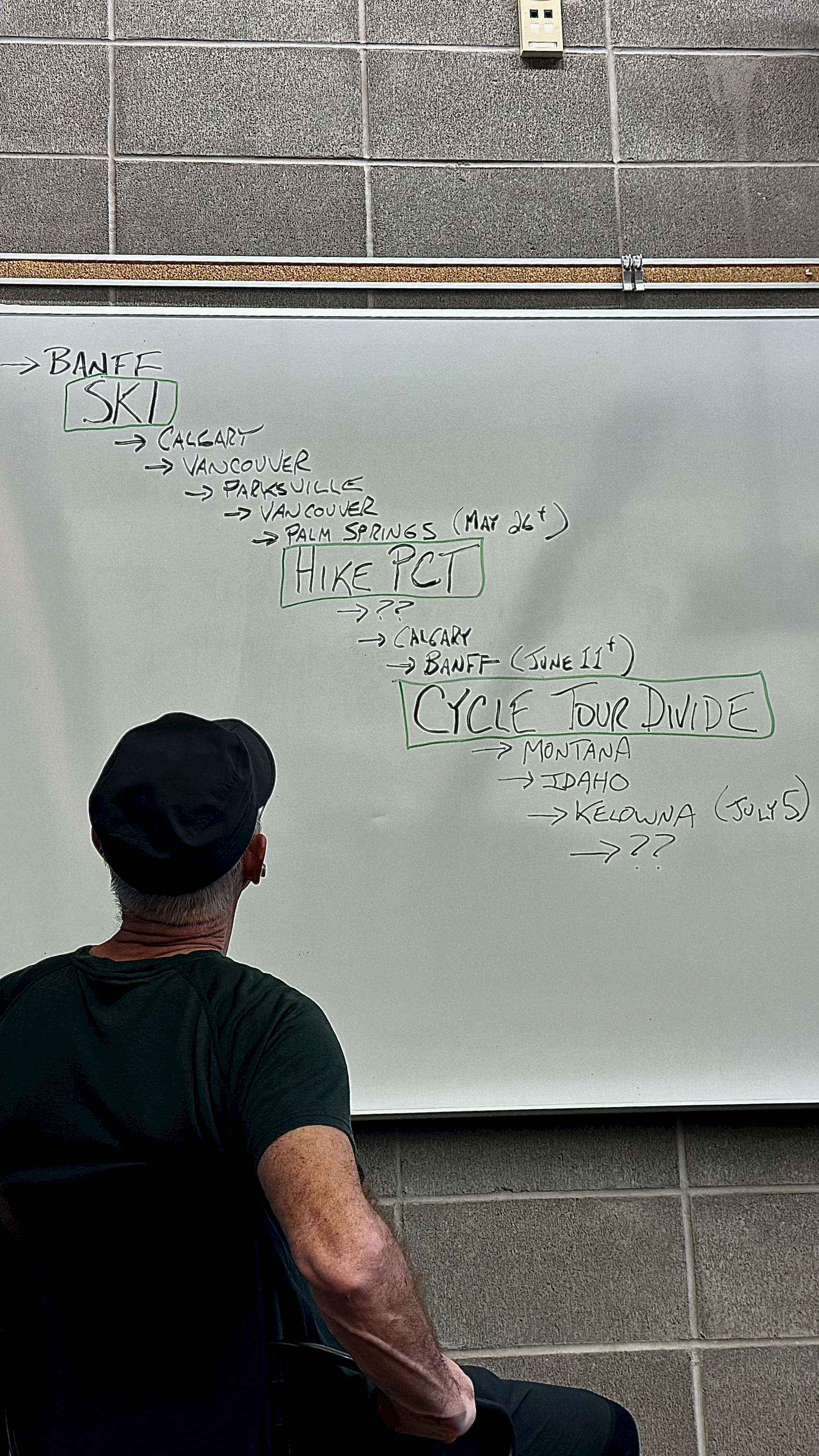
Starting my 4th week of skiing out of Banff.
I have a permit to backpack a couple of weeks on the world’s best long thru hike – the Pacific Crest Trail. Starting May 26th out of Palm Springs, California.
AND I want to get back to Banff by June 12th (or shortly after) to start the Tour Divide – the world’s most famed long distance cycling route Canada to Mexico.
I won’t be trying for Mexico.
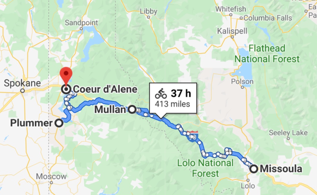
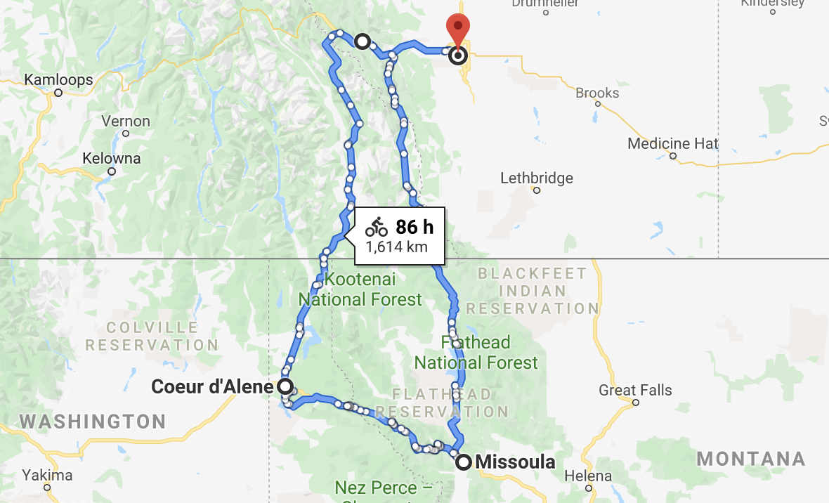
From Missoula, Montana I’ll divert to Idaho. And on to Kelowna, B.C. for a reunion with lifelong friends.
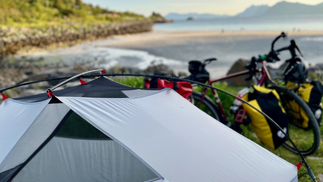
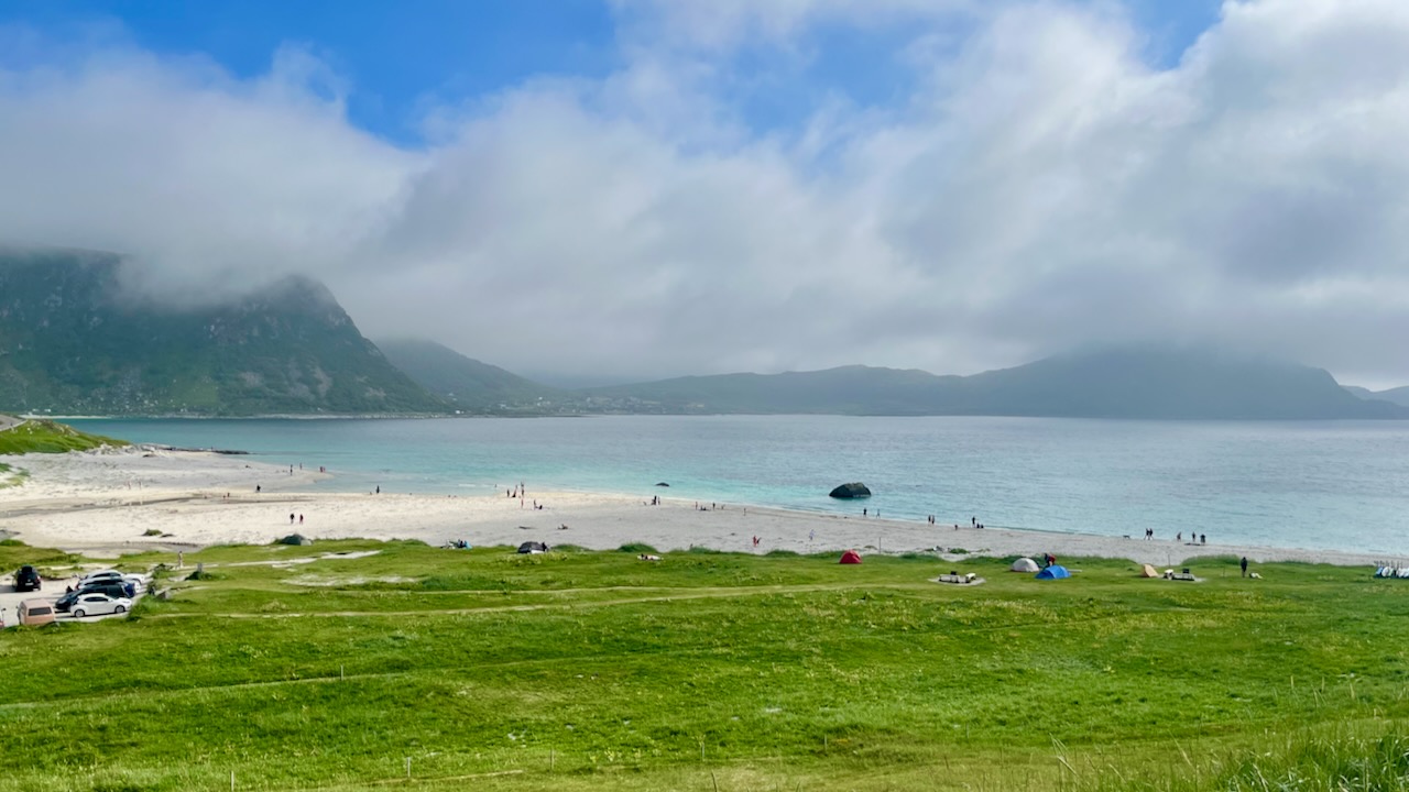
That’s a private campground that cost$ money. In 2023 I went instead to the free beach nearby called Haukland. Also good, but not as good.
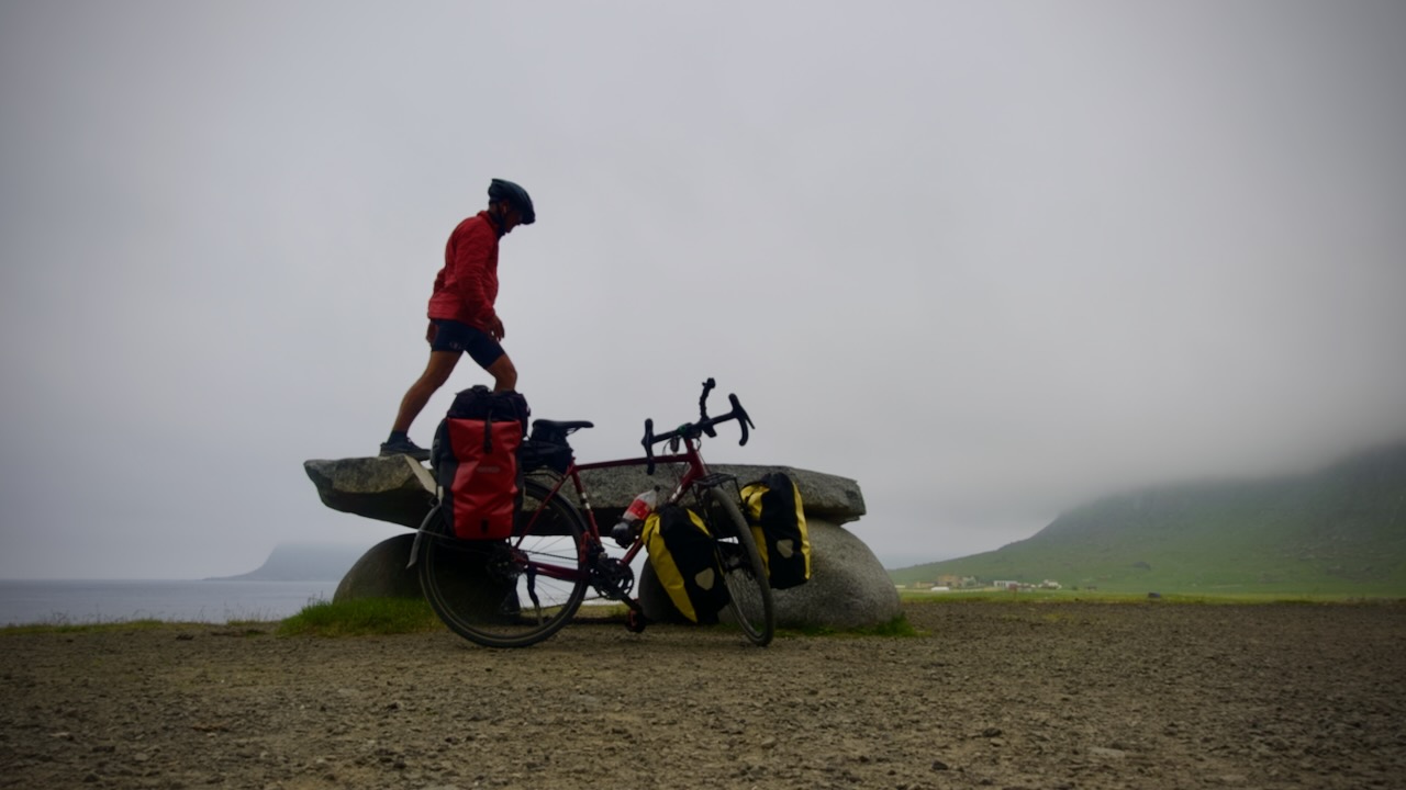
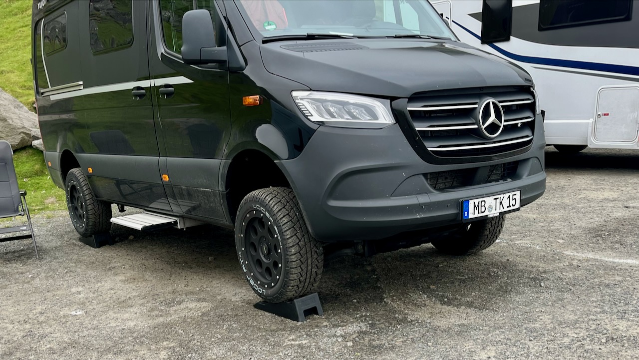
As parking lots are rarely level, everyone carries these plastic wheel lifters for their vehicles.
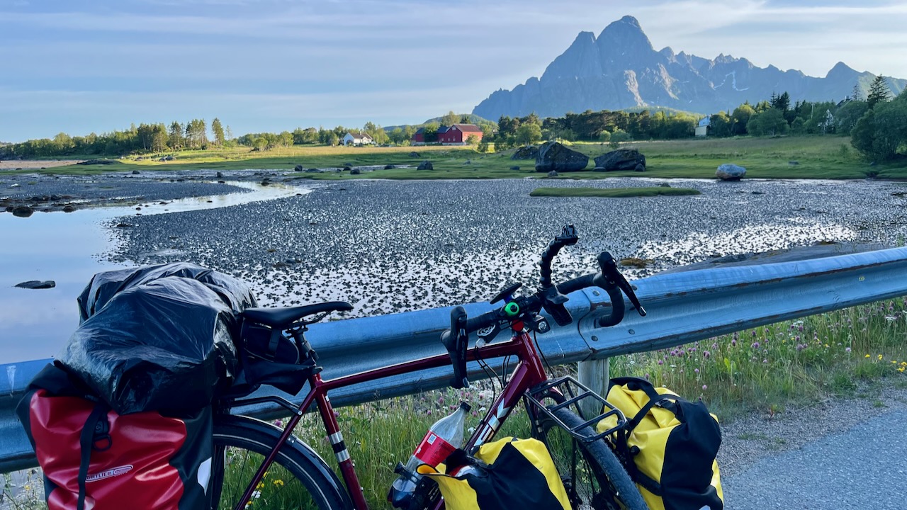
Day 8 — July 8th, 2023
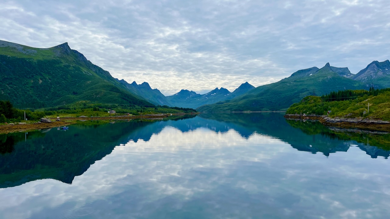
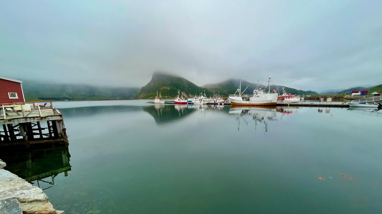
Low fog and misty rain. I decided to cycle to one of two hostels in Lofoten ➙ Lydersen Rorbuer.
Stayed 2 nights taking a break and getting some photos and video edited. Did laundry.
I had a great time in 2022. And enjoyed it just as much in 2023.
Here’s the view from the hostel. Low cloud, as you can see.
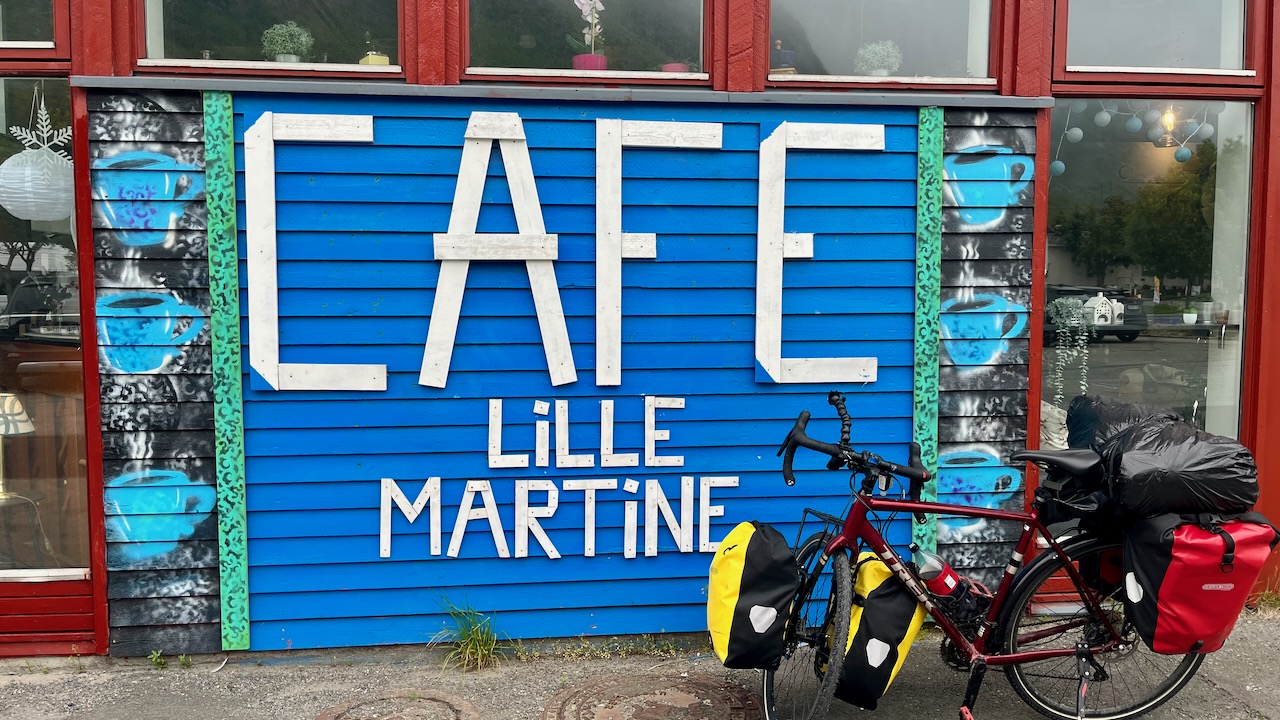
Nearby is a good store and cafe.
My most mellow day, so far.
Day 9 — July 9th, 2023
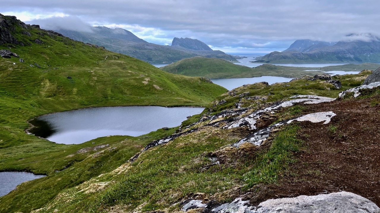
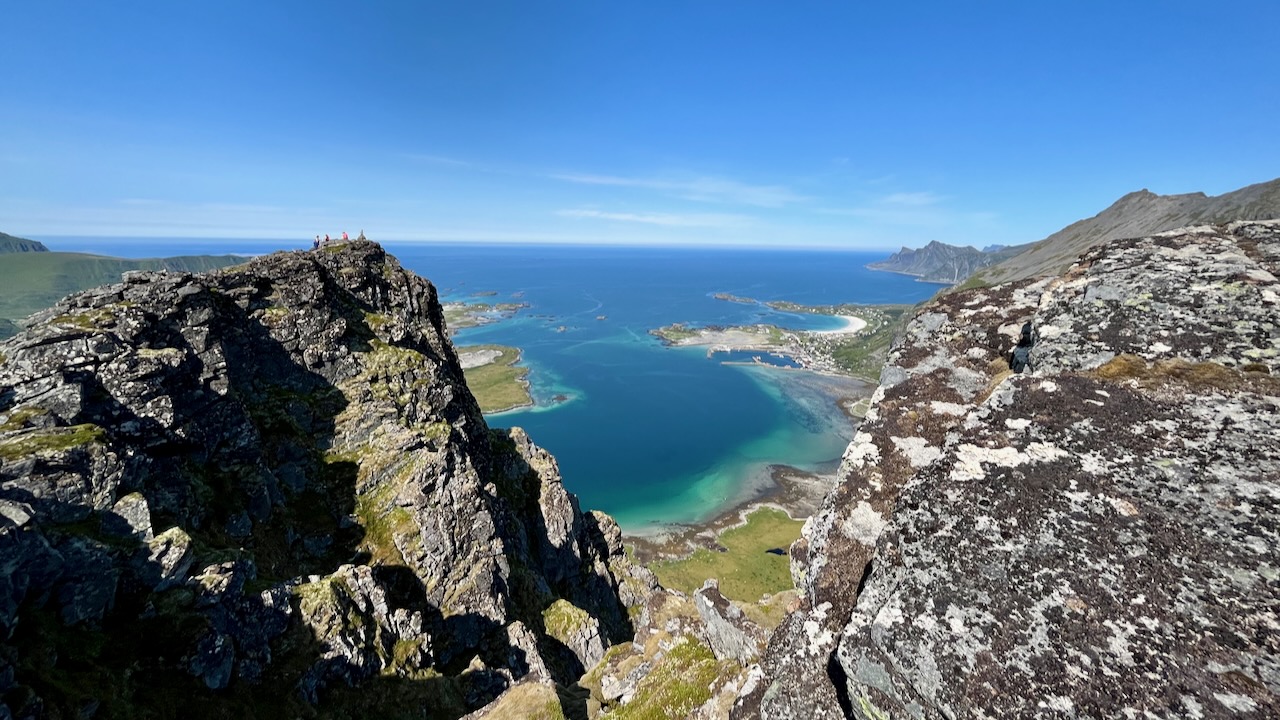
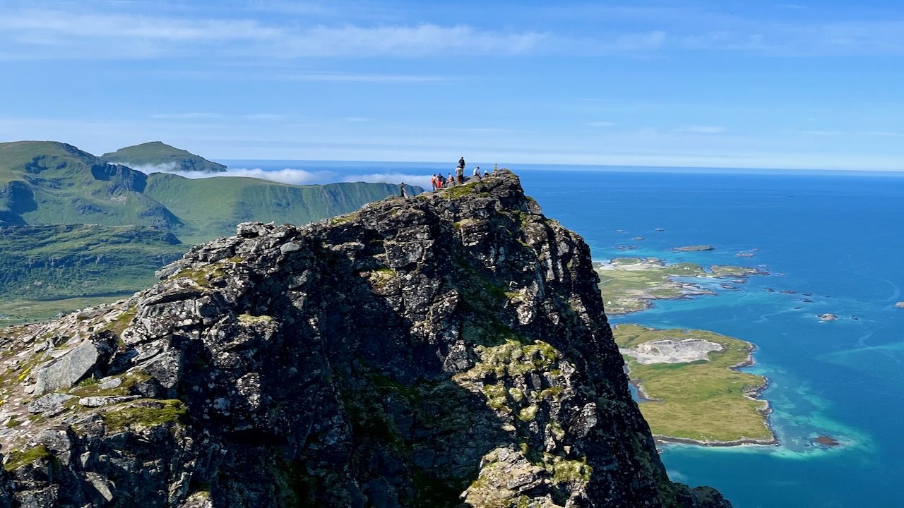
Weather was expected to improve today. Some headed up to the main hike from here ➙ Ryten.
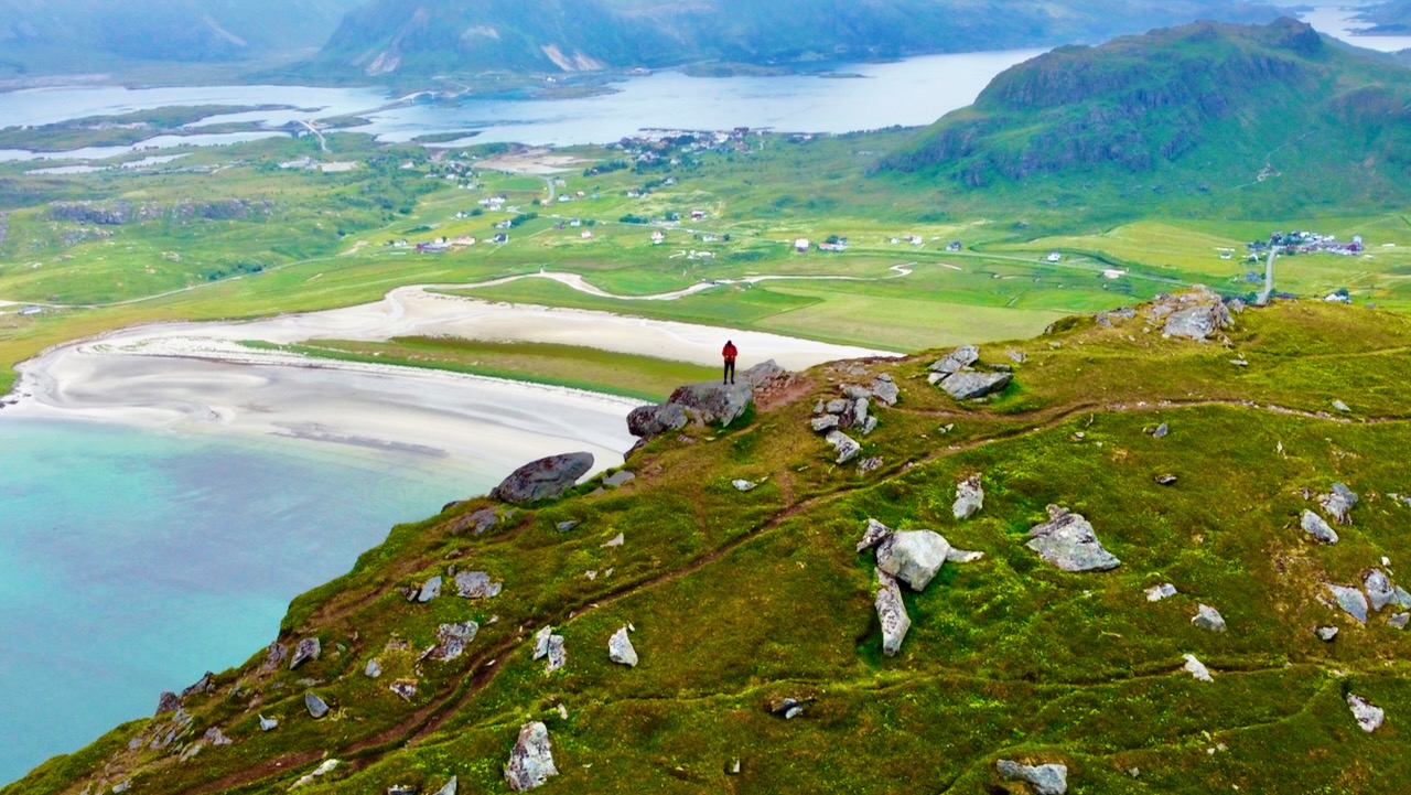
As I’d done it in 2022, I headed instead to a lower hike called Ytresandheia – Røren. Excellent, though I’d not even heard about it. It’s the alternative to Ryten when the peak is socked in.
Ytresandheia – Røren
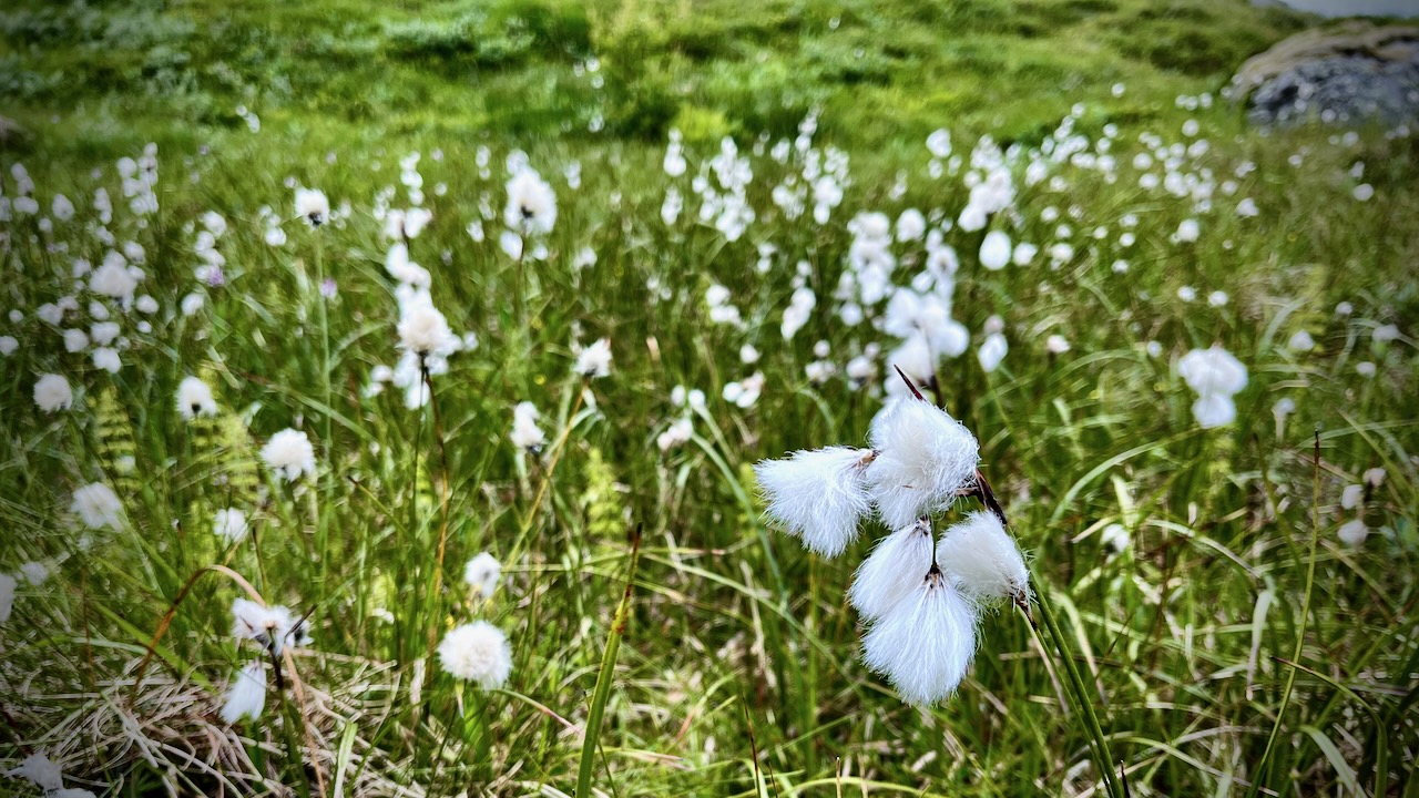
Later — having finished my video editing — I took an evening hike. This photo was shot at 9pm, for example. There is no night above the Arctic Circle in early July.
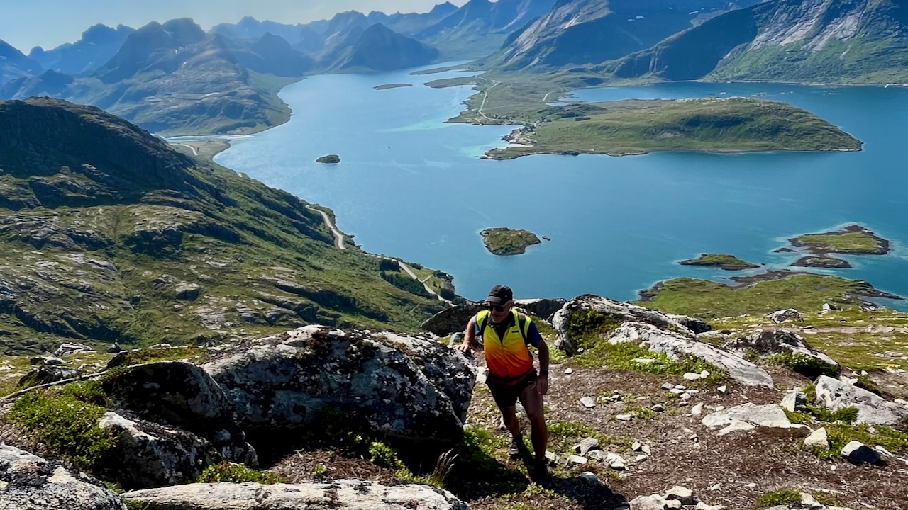
Day 10 — July 10th, 2023
Next morning I cleaned and organized my gear.
There’s an impressive looking peak called FLAKSTADTIND you see out the window of the hostel. Staff told me it’s actually quite easy and popular with locals.
With the good weather, it was fantastic.
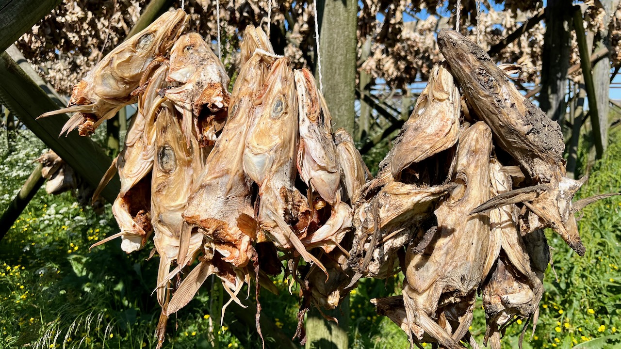
Continuing on south, I stopped to fly the drone through one of the many fish drying racks. Typically cod is hung for about 16 weeks. Much is sold to Italy and Africa.
When I rolled through Reine, weather was perfect. I knew hundreds of people would have climbed 448m to the top of Reinebringen. It would be VERY crowded.
Having done the most popular photo op in Norway twice before, I gave it a miss this time.
But here’s the VIDEO as I can’t resist posting it again. 😀
Instead I cycled leisurely to the end of the line ➙ the quaint village of Å.
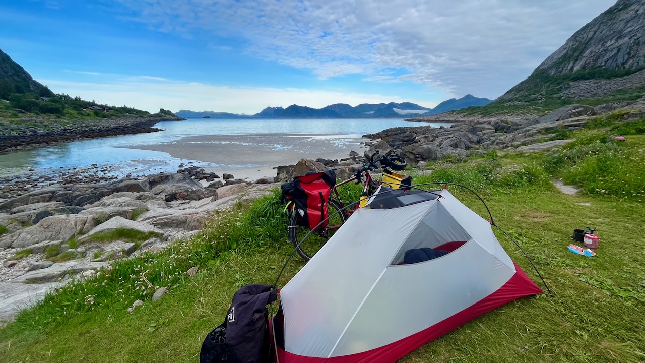
I’d hoped to hike and tent — but it’s not legal nor possible anywhere near Å. Lovely evening, however.
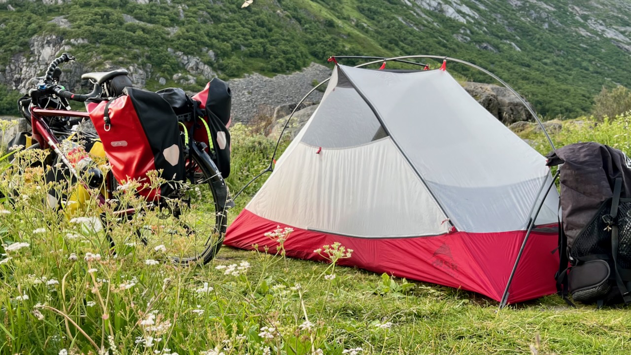
I had to backtrack to find a campsite. Even with this vista, I felt it was the least excellent so far in Norway.
Day 11 — July 11th, 2023
It seemed crazy to leave Lofoten with the weather so good — but I rolled on to the free ferry to Bodø.
Farewell Lofoten. One of the best hiking destinations in the world. Know that roads are actually quite crowded and narrow for bicycles. But most of the traffic is tourists, most sympathetic for cyclists.
Ultimately, I had to quit after day 3 because of illness.
Drinking from the same hoses and standing pipes as every other cyclist, I suffered some sort of stomach problem. Diarrhea. Threw up on my shoes, at one point.
Didn’t eat for about 36 hours.
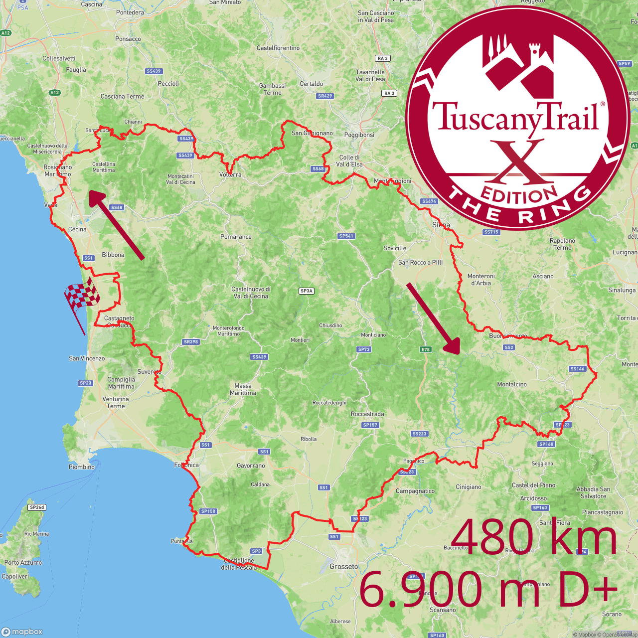
BUT if not sick I might have still quit after Siena. Completing about 190km of the 472 total.
For one thing, the afternoon lightning storms were terrifying. Even the most experienced riders hunker down in lightning. Two were killed in Tuscany as I post — both hit by falling trees.
The rain turned some trails into impassable mud baths. … Though it did soften up some other trails.
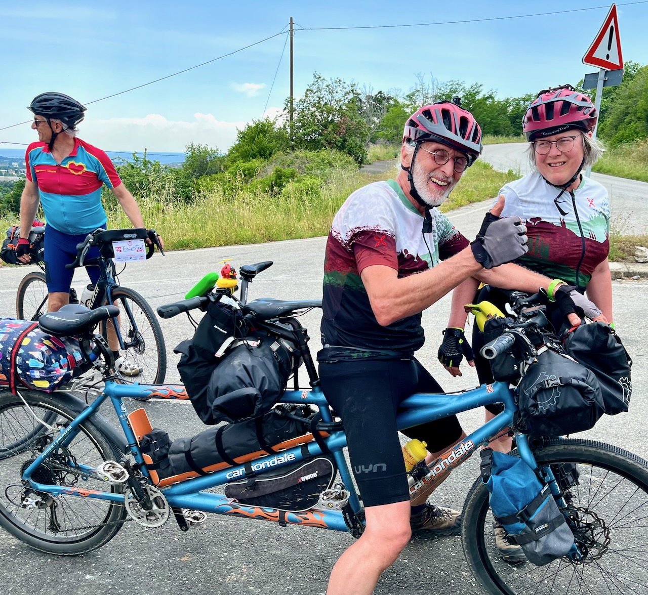
My bike is excellent for normal bikepacking — but the Tuscany Trail was far more technical than I’d expected. A mountain bike with very little weight attached is what most experience riders were rocking.
I was envious of the electric mountain bikes.
My bike was the 2nd most inappropriate rig. Worse was a 2-person tandem. Husband and wife. I wished them luck.
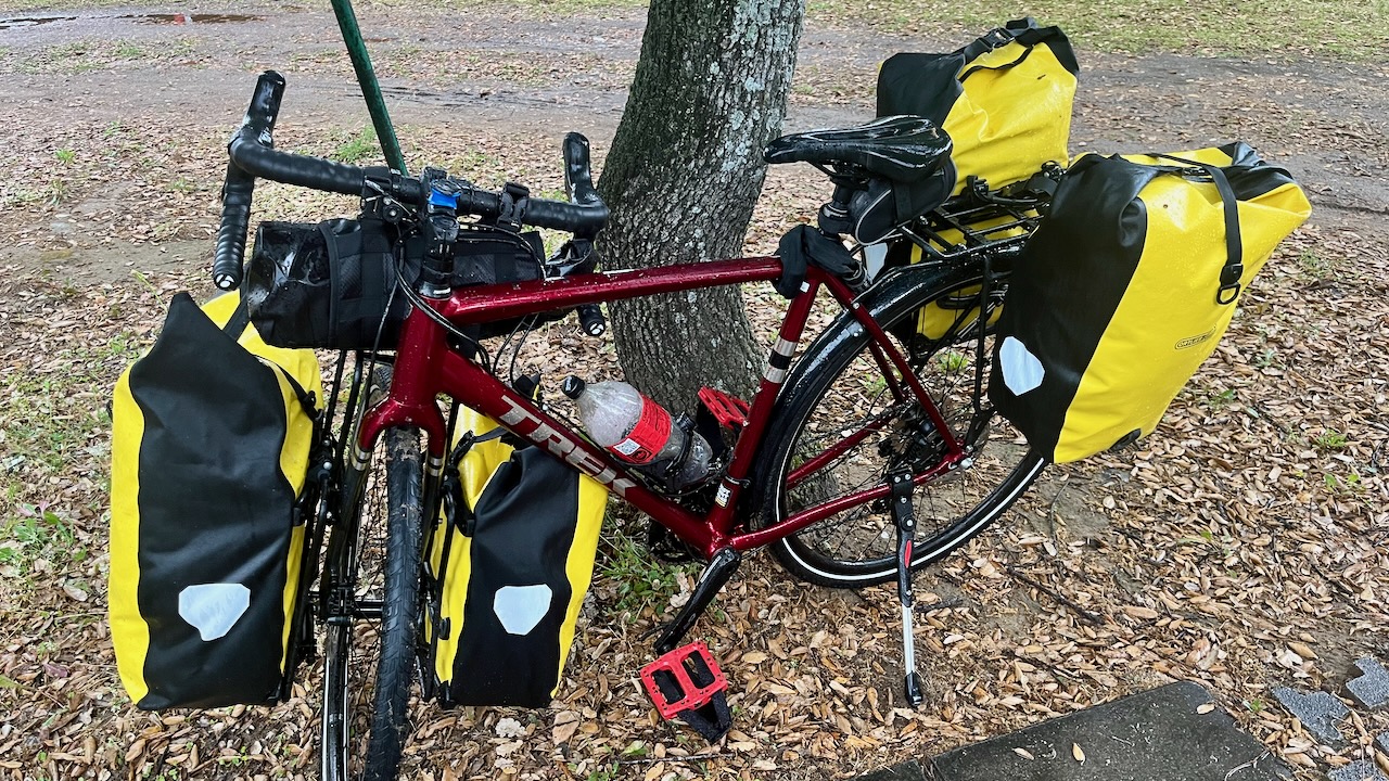
I was cycling with ALL my gear for a months long trip.
On one of the many downhill, rocky trails a screw came loose on my front pannier rack. So my front saddle bags were rocking side-to-side.
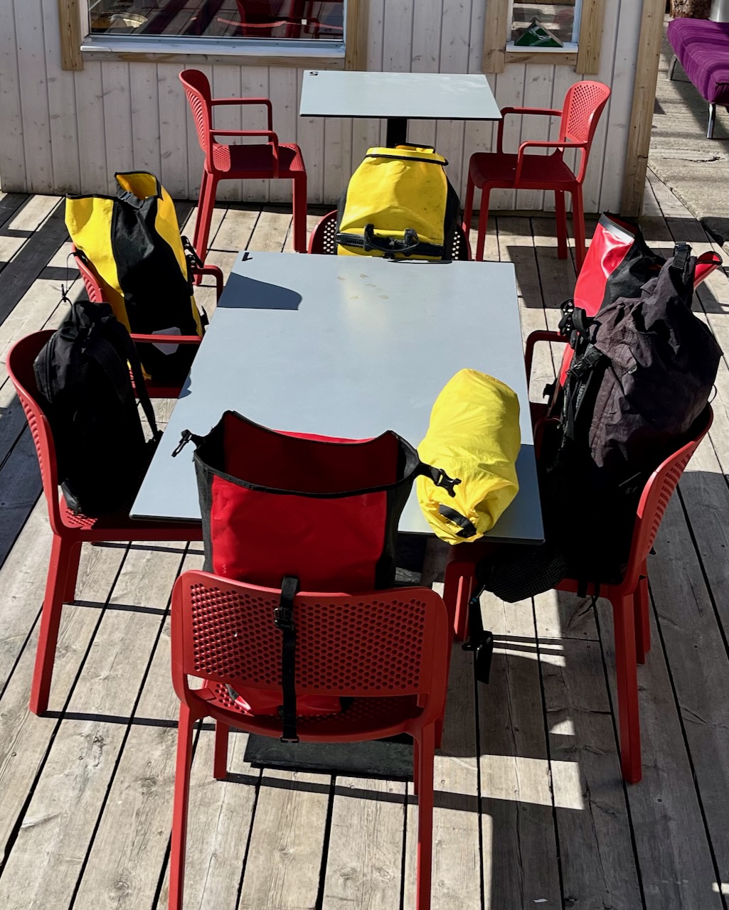
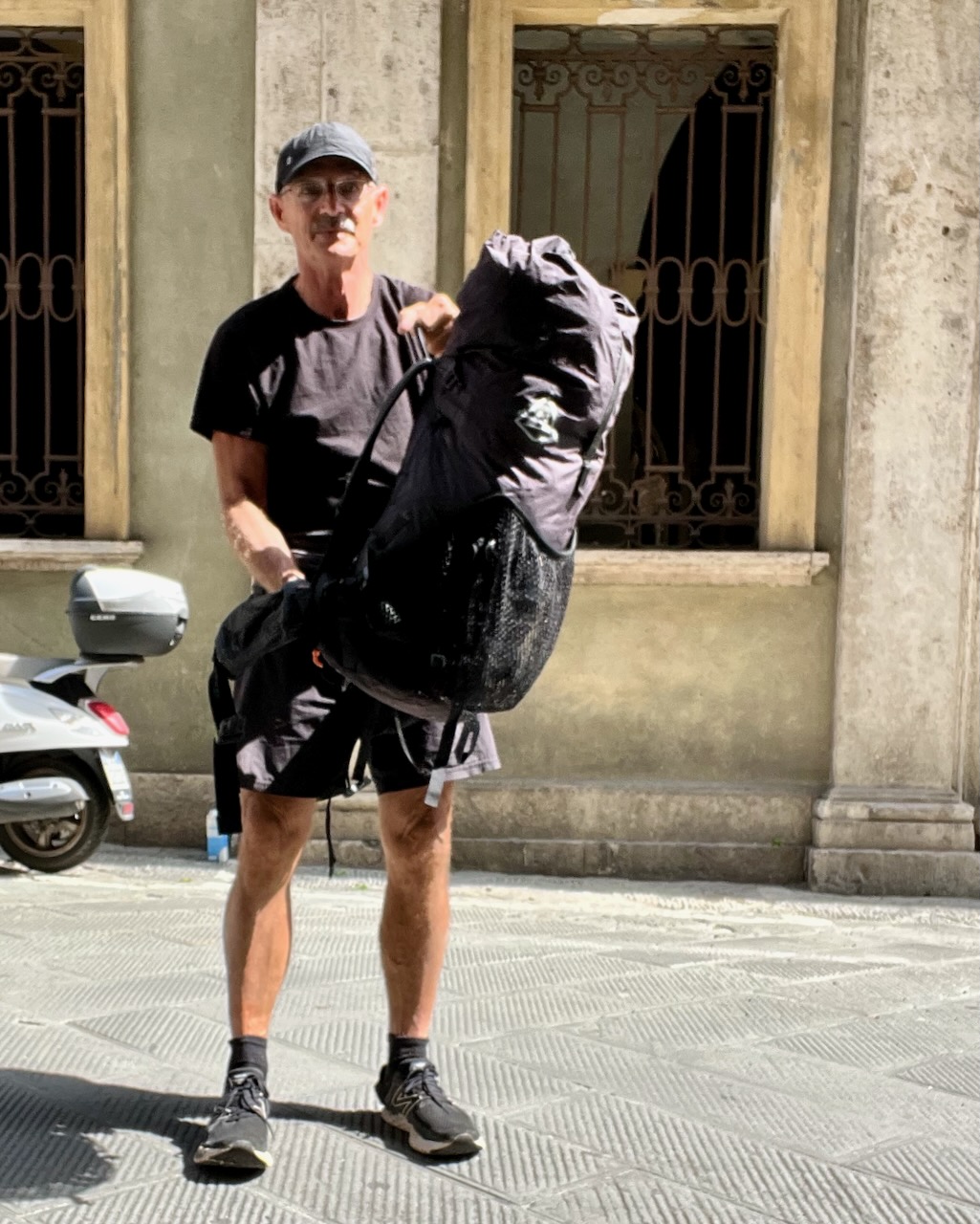
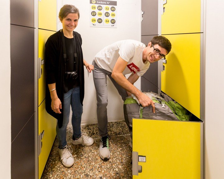
In Siena I took as much off the bike as possible (see photo below) and went to find luggage storage.
IF you Google “siena luggage storage” you’ll find a wealth of options.
All lies. In Siena there are only tobacco shops who hold a few bags as side income. And they only open randomly. Not Sundays. … And this was Sunday.
WHY doesn’t Siena have 24-hour lockers like most Italian tourist cities.
My theory since age-17 is that Italy is hopeless for tourists.
Nothing works. Nothing is open when you need it.
A long history of government inefficiency and corruption makes it this way.
Note that Germany and Switzerland next door are two of the most efficient nations.
There are no real enforced rules in Italy. Yet every time a tourist turns around somebody is yelling at you for violating an unnecessary rule. Yeesh.
When tourists complain, it’s explained that Italians don’t care about entrepreneurship nor efficiency because they value lifestyle over money. I don’t buy it.
Chain-smoking and sipping tiny espressos is not a healthy lifestyle.
I’d definitely return to Tuscany for cycling. But not likely the most famous ride ➙ the Tuscany Trail.
For one thing, it’s mainly a ca$h grab by organizers. They spend very little and pocket over 100 € / person. Normally capped at 3000, in 2023 they went up to about 4700 bikes. Too many for these trails and small towns.
Better, for example. is the Ganza Gravel event. October is much better weather than June. Cyclists have 3-4 different routes to choose from. Folks get together for meals in the evenings. There might even be a food festival at the end.
For those who are not really cyclists, the supported electric bike tours looked very good to me. Not inexpensive.
From there I’d most like to head back up to the Dolomites. On to Switzerland. And north to Arctic Norway to start the LONG ride I had planned for last summer. CANCELLED when SAS Airlines failed to deliver my bike.
UPDATE. I had to cancel this adventure for 2022. Hopefully I can reschedule it for 2023.
It’s free. No registration. No commitment in advance. I could show up … or not.
I’d dreamed of lining up with Lael and watching her for about 45 seconds as she pedalled out of sight. 😀 Sadly Lael is not racing 2022. She’s in Europe this summer, instead.
The Tour Divide roughly follows the Great Divide Mountain Bike Route (GDMBR) is the most recognized and important off-pavement cycling route in the United States, if not the world.
The route crisscrosses the Continental Divide from north to south starting in Banff, Alberta, Canada and finishing at the US/Mexico border in Antelope Wells, New Mexico.
I don’t have time, bike or talent to do the whole thing. But I’m hoping to ride the start down into Montana. Then divert over to Coeur d’Alene, Idaho where I broke down on my 2019 Great American Rail-Trail bikepacking adventure. Dave Adlard had to rescue me. 😀
This adventure is the flagship achievement of Bikepacking Roots, a not-for-profit advocacy group founded by Kurt Refsnider and Kaitlyn Boyle in 2017.
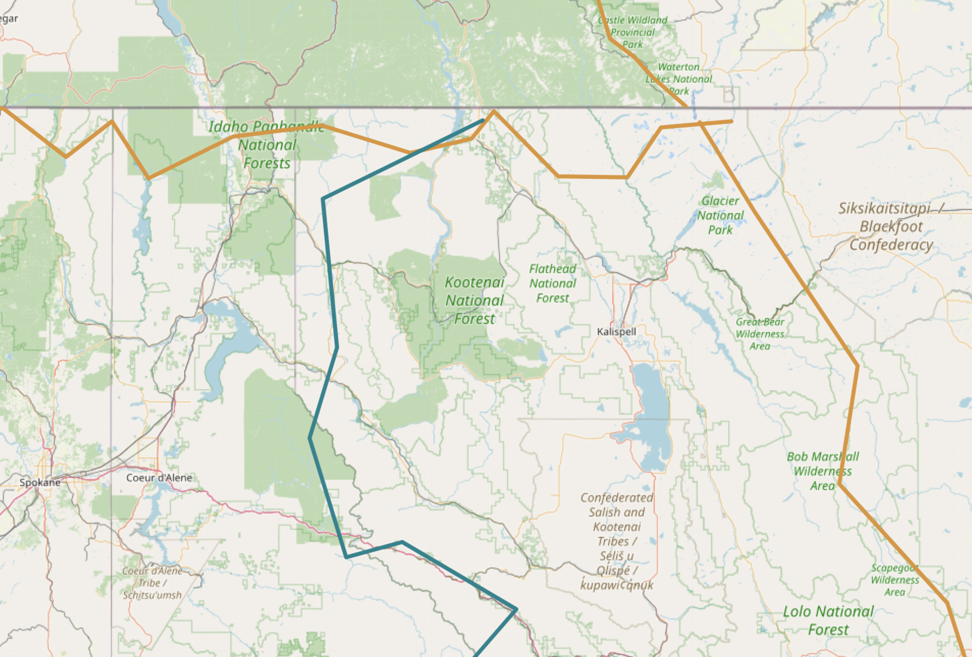
It’s less technical and easier for touring bikes than the Divide — so I may divert on to the Western Wildlands starting at Eureka, Montana. I’ll see how I’m feeling at the time. 😀
Blue line to the west is the Western Wildlands Route
Likely I’ll end up making a loop of the two routes, returning to Calgary via Eureka.
For navigation I’ll likely be using the paid FarOut app (formerly Guthook) as it’s the most popular for both Divide and Wild West. But I hope to have backup maps, as well.
Blood Road, according to director Nicholas Schrunk, “set out to document an epic cycling expedition as well as Rebecca’s personal journey to visit the crash site [of her father], but we ended up uncovering something much deeper.
It’s a story about the scars, both physical and emotional, that war leaves on families, countries, and cultures, and how they still exist today.
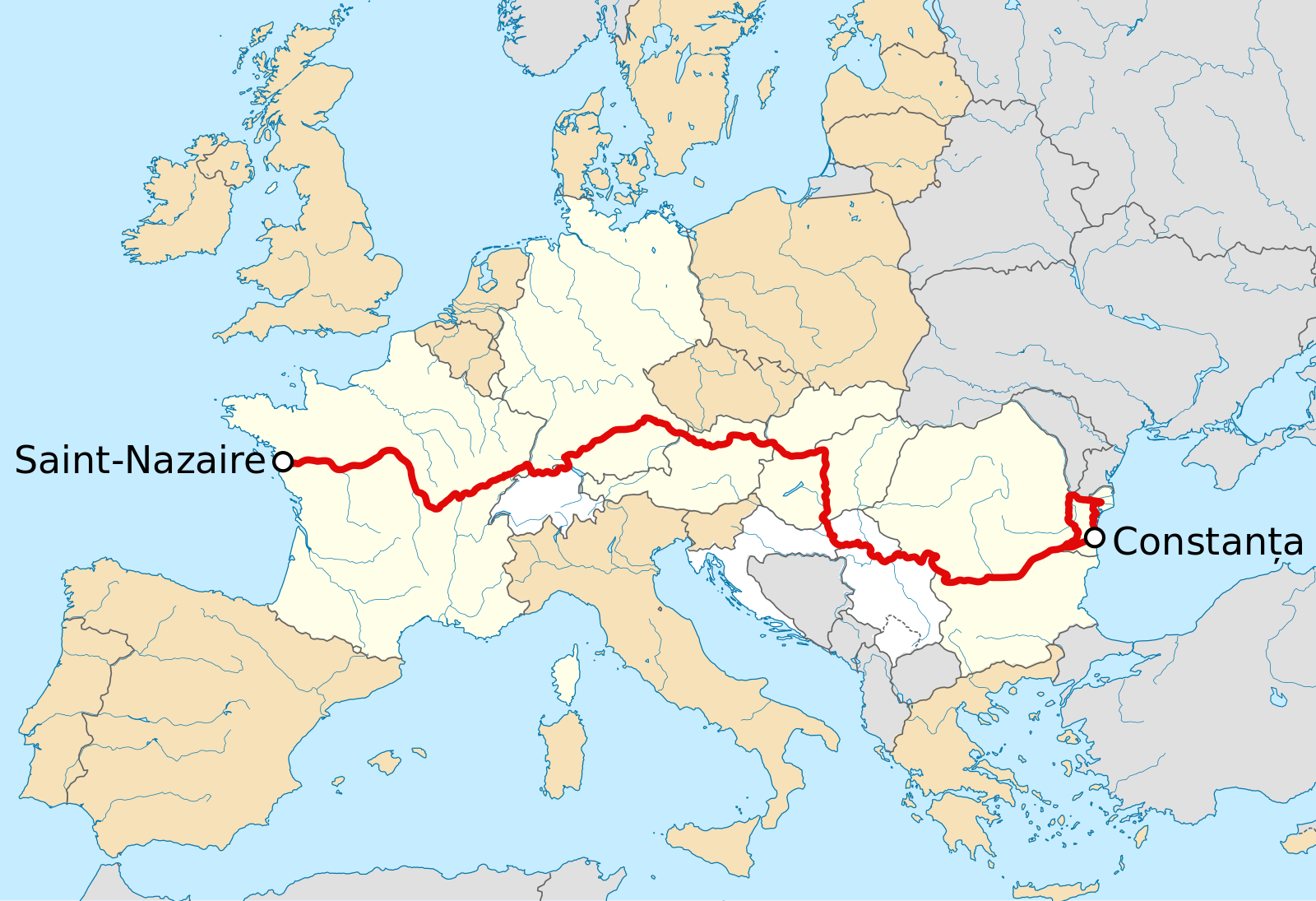
EuroVelo 6 (EV6), named the “Rivers Route”, is a long-distance cycling route that runs along 3,653 km (2,270 mi) some of Europe’s major rivers, including much of the Loire, some of the Saône, a short section of the upper Rhine and almost the entire length of Europe’s second longest river, the Danube — from the Atlantic coast of France to the city of Constanța on the Black Sea.
The EV6 traverses ten countries …
Lauren Pears went for a 3 month solo bike ride across Europe last summer – from London to Istanbul – whereby she used the EuroVelo 6 – Atlantic-Black Sea for most of the way. …