Charles Darwin – Voyage of the Beagle

Recommended.

I read this book in advance of heading down to Tierra del Fuego (Land of Fire) and did find it interesting.

For the time Darwin was an enlightened man. Though he believed the British were doing good bringing civilization and Christianity to the savages, he did come up with the theory of evolution based on this trip. Today the FACT of evolution.

Darwin was open minded enough to believe what he saw with his own eyes.

I was surprised to realize that the Beagle voyage was very late in the takeover of South America by Europeans. Population of Montevideo, Uruguay was already 15,000 by the time Darwin got there.

Magellan got to Tierra del Fuego over 300 years earlier. Cook over 60 years earlier.

Darwin’s captain was Robert FitzRoy.

Mount Fitz Roy (ArgentinaChile) was named after him … though misspelled.


The Voyage of the Beagle is the title most commonly given to the book written by Charles Darwin and published in 1839 as his Journal and Remarks, bringing him considerable fame and respect. This was the third volume of The Narrative of the Voyages of H.M. Ships Adventure and Beagle, the other volumes of which were written or edited by the commanders of the ships. …

The Beagle sailed from Plymouth Sound on 27 December 1831 under the command of Captain Robert FitzRoy.  …

Darwin spent most of this time exploring on land (three years and three months on land; 18 months at sea). The book is a vivid travel memoir as well as a detailed scientific field journal covering biology, geology, and anthropology  …

The Dictator’s Highway by Justin Walker

I survived the Gawd awful Walking Patagonia by Caspian Ray on Kindle. The worst book I ever read.

By contrast, the second book I read on Kindle was superb.

The Dictator’s Highway (2015) by Justin Walker. Well written, insightful and superbly researched.

Walker did the Carretera Austral in Chile where Ray stumbled in parallel on Highway 40 in Argentina.

Skip Ray. Read Walker.

CHILE to ARGENTINA the hard way

Once in Villa O’Higgins, Chile you have two choices for continuing south to Fitz Roy National Park in Argentina.

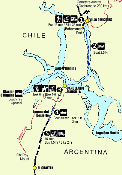
You can backtrack and drive 19h 43min (1,072.4 km) or …
continue by ferry and on foot.

This must be one of the wildest (legal) border crossings on earth.

I knew it was complicated and often fraught with complications. (e.g. Ferry doesn’t go due to too much wind.)

I knew it took 1-3 days … depending. 🙄

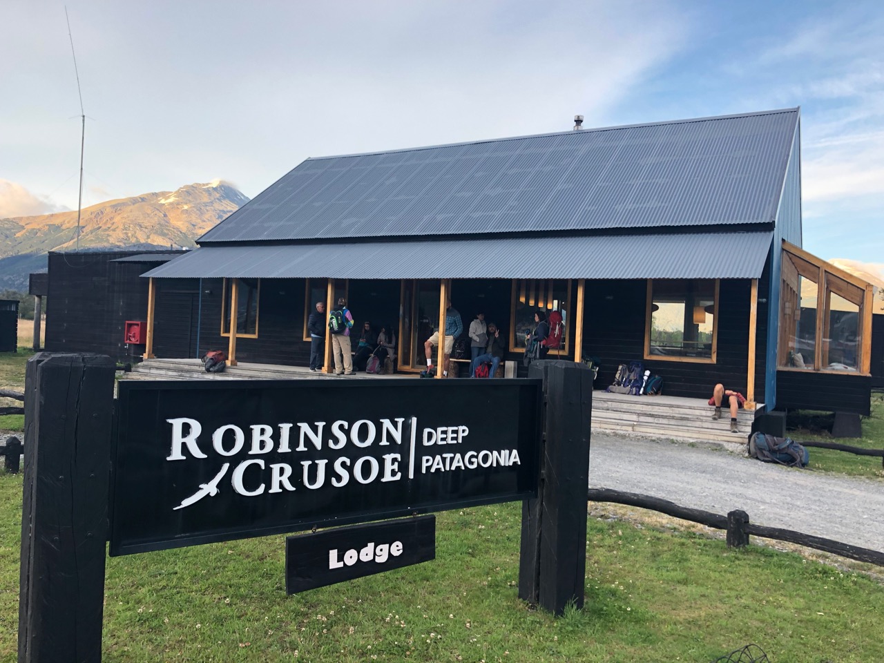
So I figured I’d best do it the easiest way possible —> signing on with the expensive Robinson Crusoe tour company.

I paid them C$160 and figured they’d get me across in 1 day. … And stopped worrying.
That was a mistake. 😕

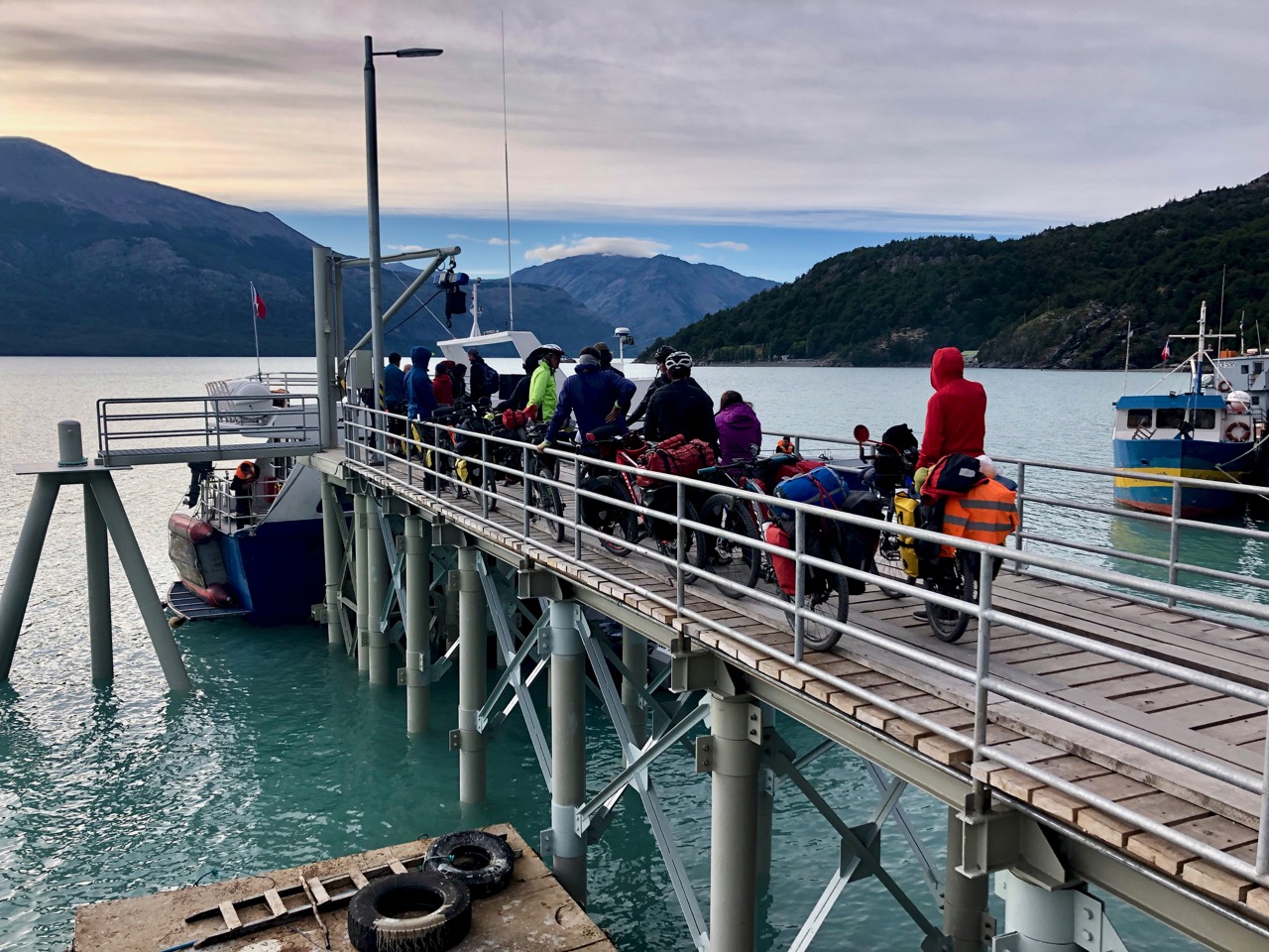
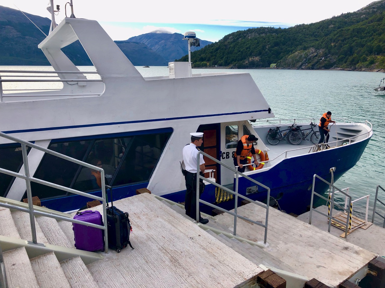
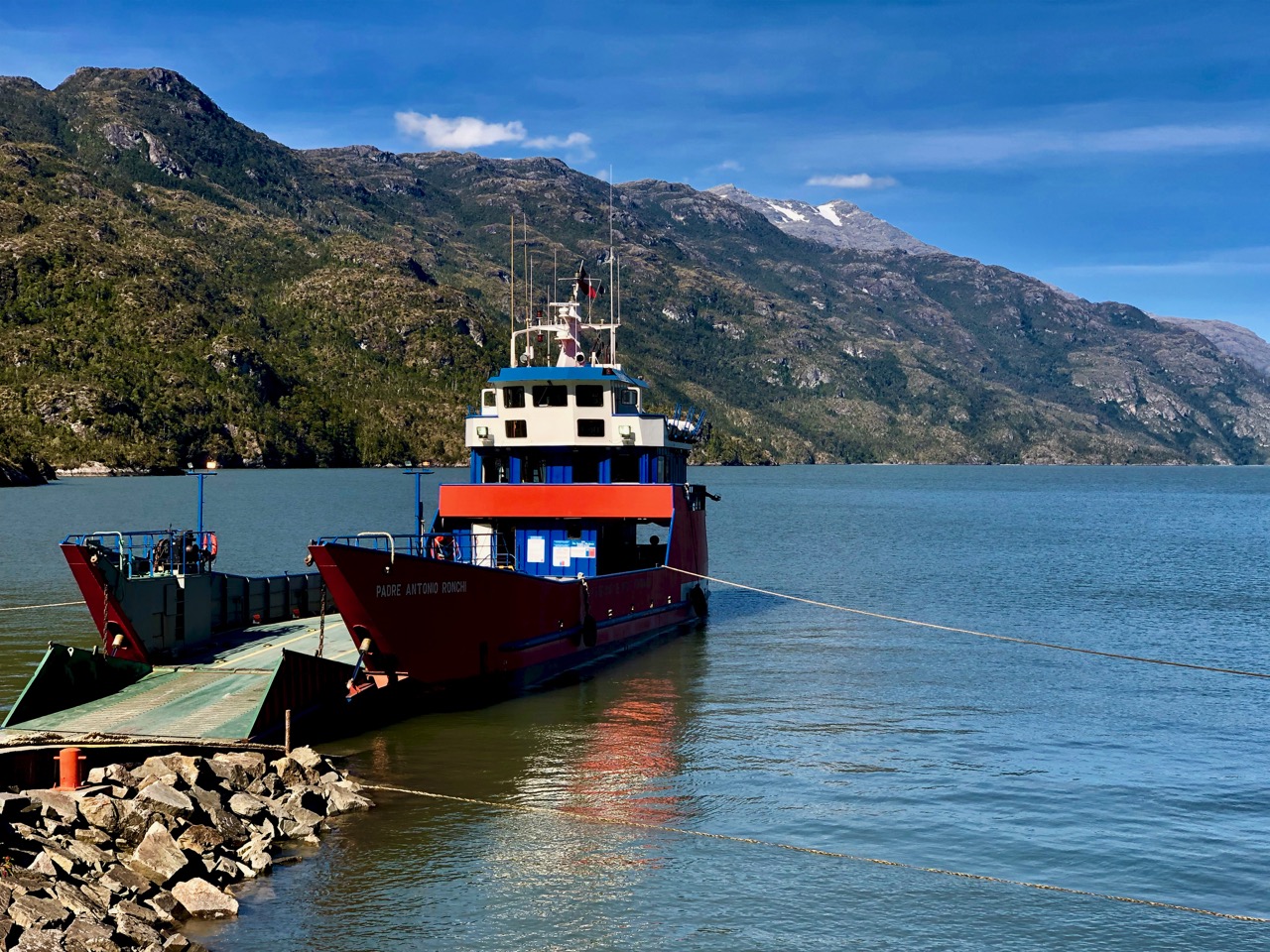
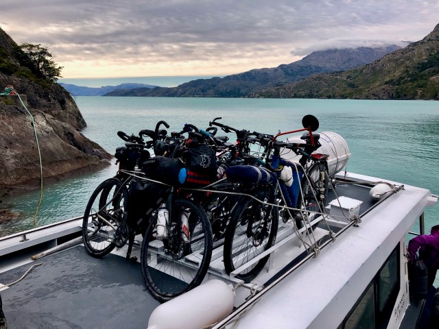
We left Robinson Crusoe lodge at 8am for the short mini-bus ride to the first ferry. There were more cyclists than passengers on foot.

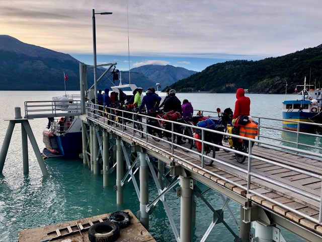
Boarding was confusing. There were two companies. And Robinson Crusoe had two different boats.

I was NOT welcomed on the nicer one.

Turned out the nice one does a side tour to a glacier. If you pay extra for it you can’t make the crossing in 1 day.

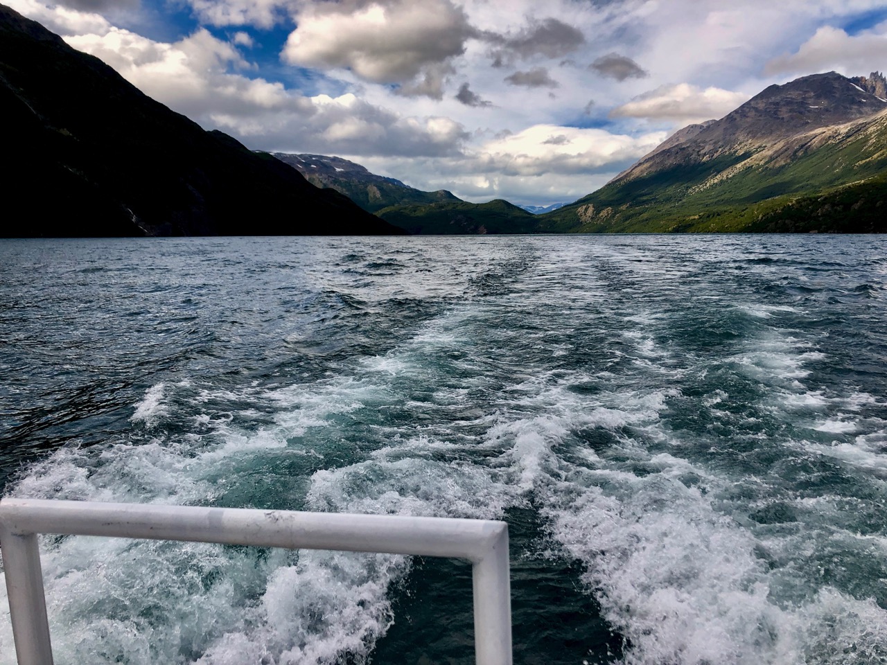
My boat was smaller and rougher. Though faster.

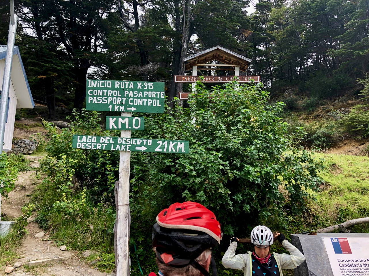
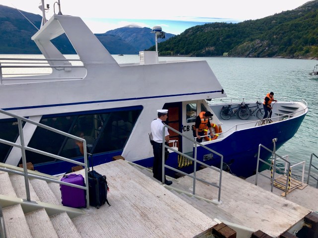
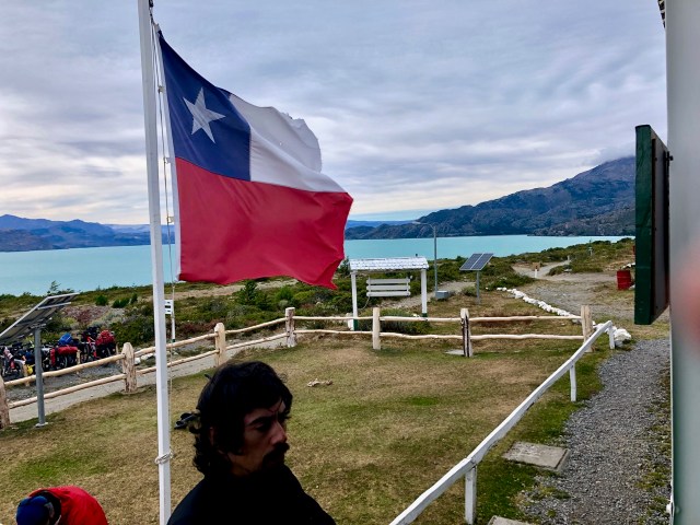
Once across to no man’s land, you check out of Chile.

This was to be our biggest problem. A very diligent border guard was SUPER slow processing anxious travelers. I was there nearly 2 hours.

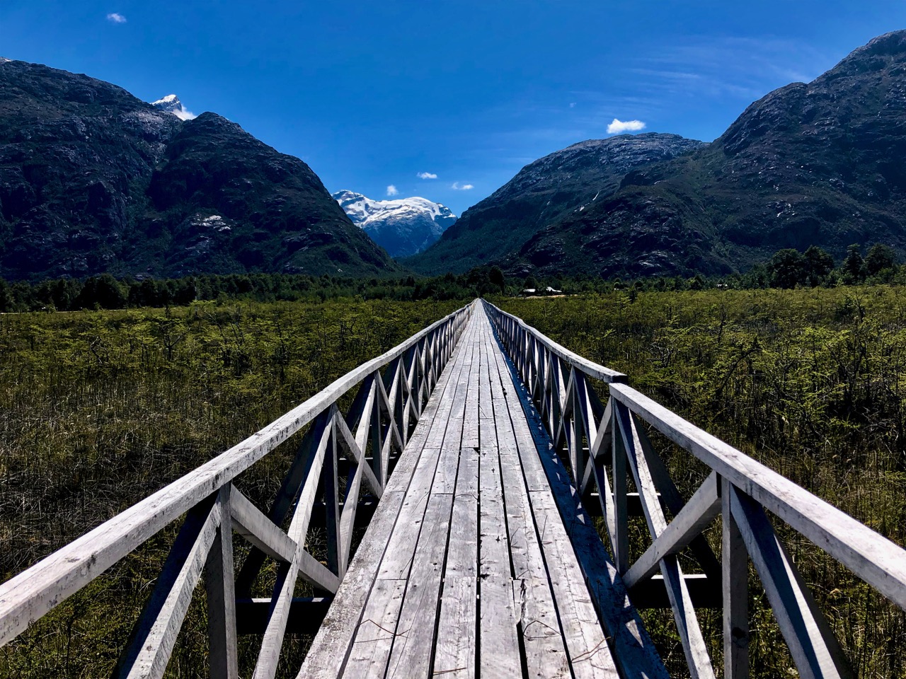
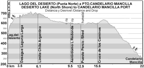
Once stamped out of Chile you have to walk 22km to the border post for Argentina.

As I paid good money it was ASSumed that my tour company would somehow shuttle me that distance.

No.

I walked like everyone else. It took me about 5 hours and I only made the second ferry with 30 minutes to spare. (I did send my backpack on a vehicle for 15km. That cost an extra C$10.)

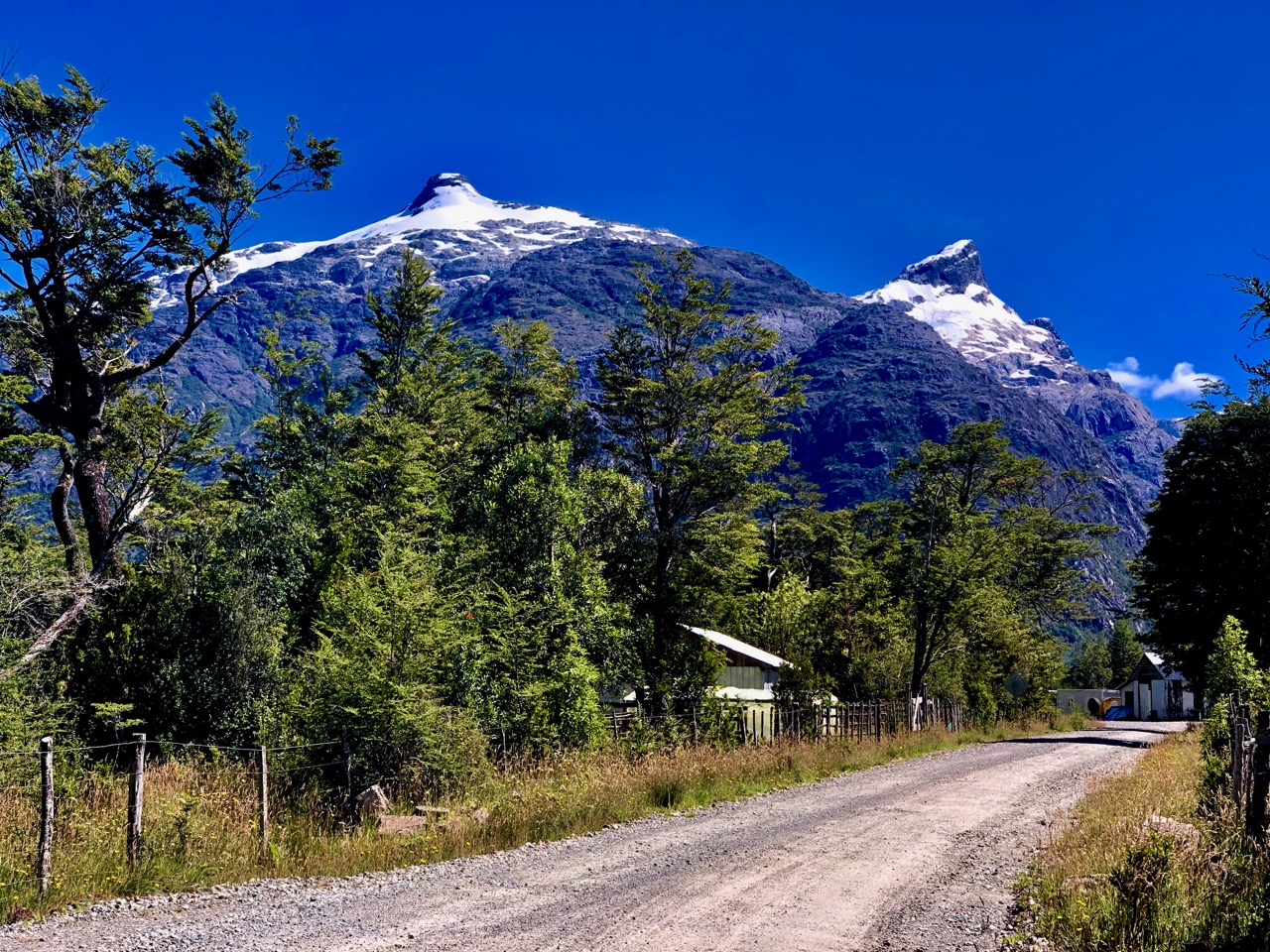
It involves a climb of 700m.

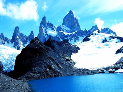
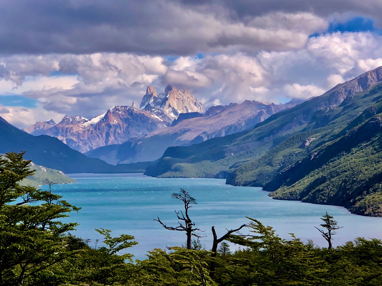
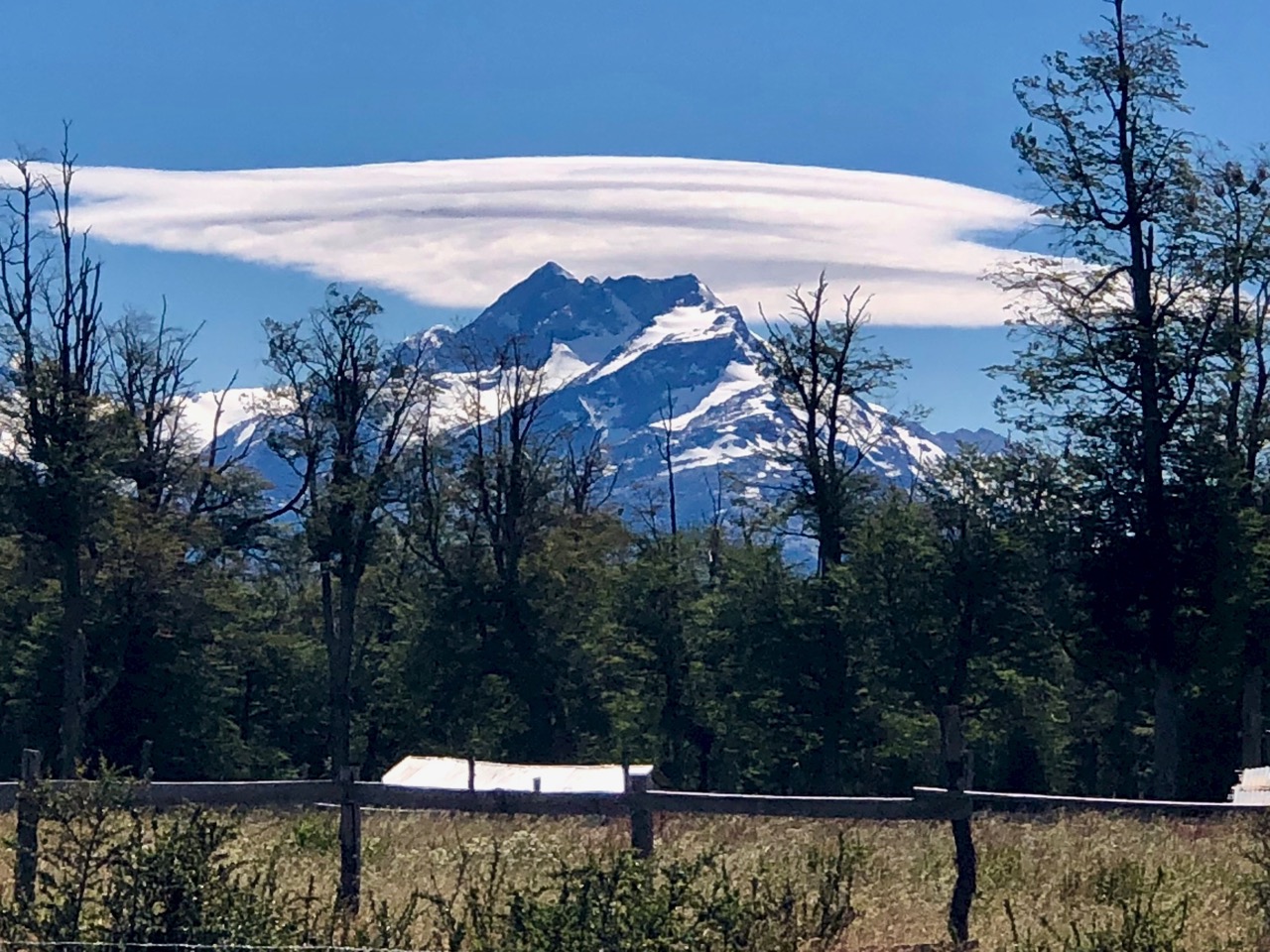
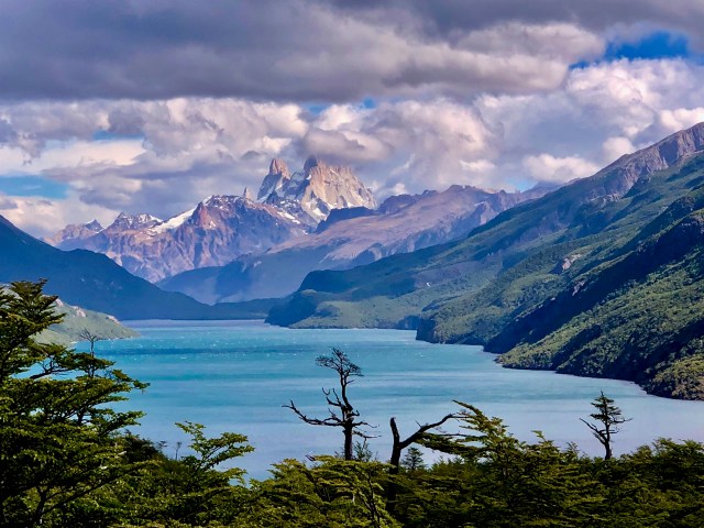
Worried that we wouldn’t make it on time, our spirits were greatly cheered when we got our first glimpse of the famed Fitz Roy peaks in the distance.

NO CLOUDS!

15 years ago I’d been there and not seen even the base of these mountains. It’s an infamously horrific microclimate.

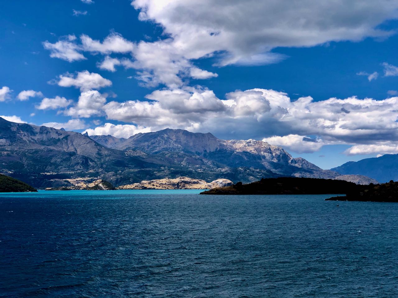
Clouds rolled in and out over the afternoon, but this is still one of the very best vantage points.

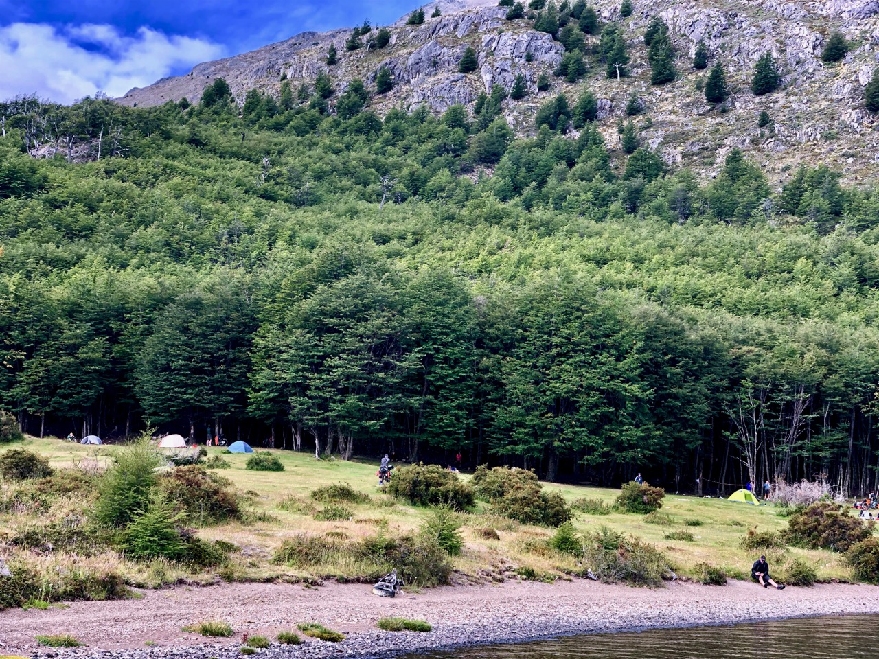
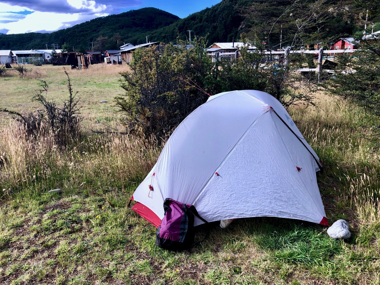
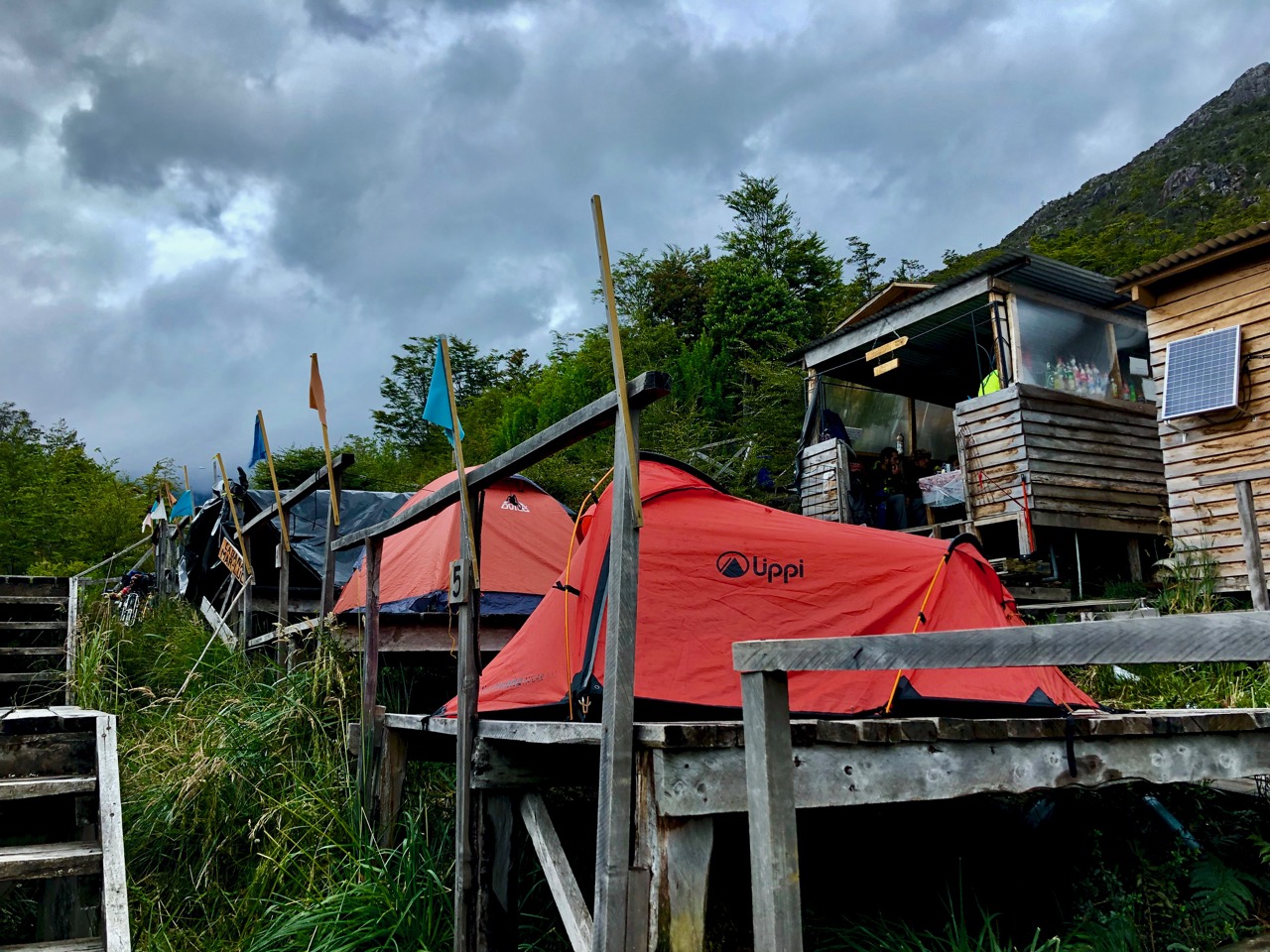
Turns out most people plan to camp at the second ferry landing in any case. And catch the boat next day. That way they are not rushed.

Some — including Sam from Calgary who I hiked with — tent here and then hike out along the lake next day to save money. (In fact 3 Calgarians met up on the trail this day!)

We were worried about an 81-year-old man from France. He almost made it.

Instead, someone loaned him a tent so he and his wife could camp.

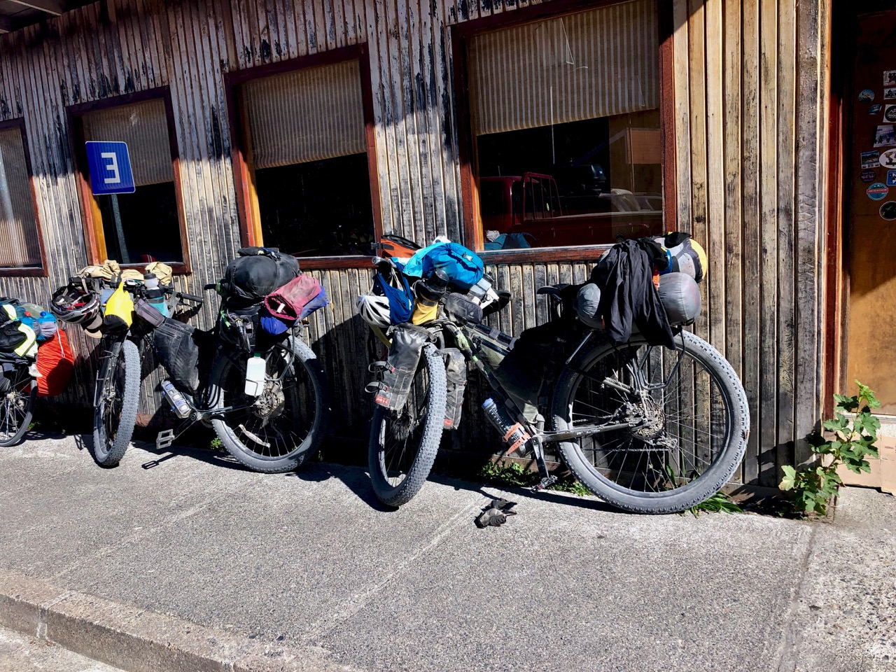
Myself and the very widely traveled cyclist in this photo did get on the boat. He and his girlfriend had cycled London to Hong Kong before heading to South America on this trip. They had the smallest gear I’d seen over the past weeks.

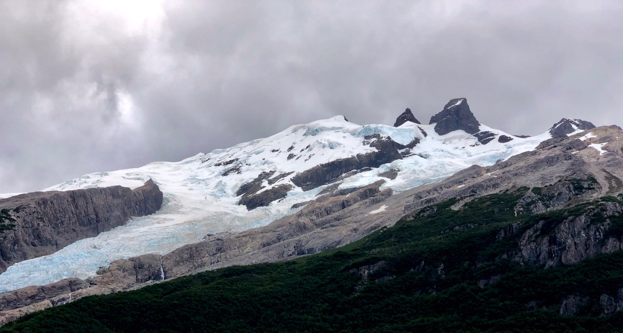
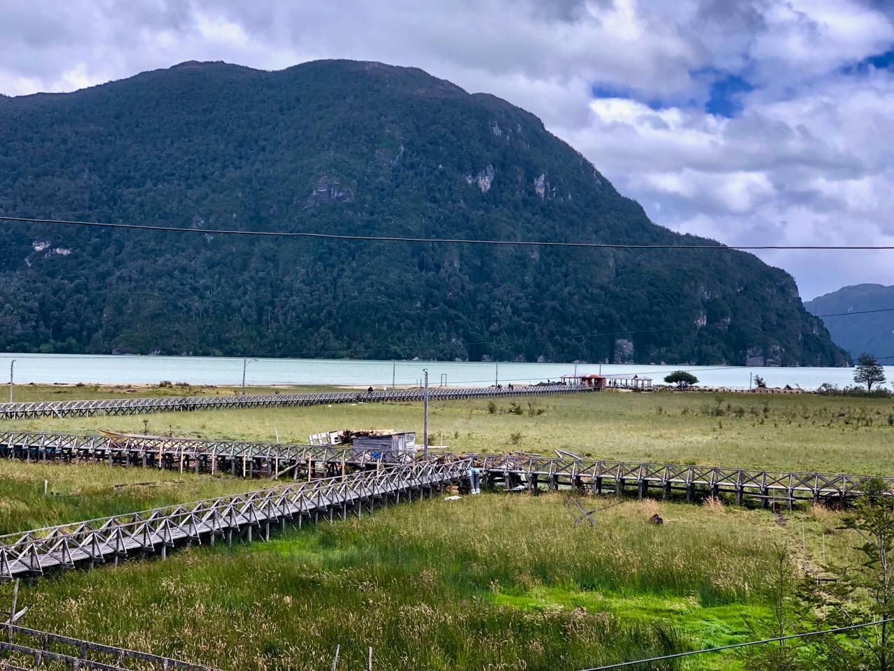
There were good views on to glaciers from the second ferry.

The lakeside trail looked pretty tough to me. There won’t be a road put in here … ever.

I fell asleep on the mini-bus ride to town. This was a non-stop 12 hour travel day.

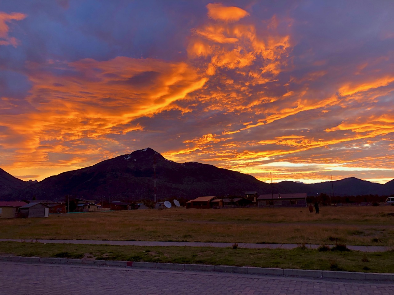
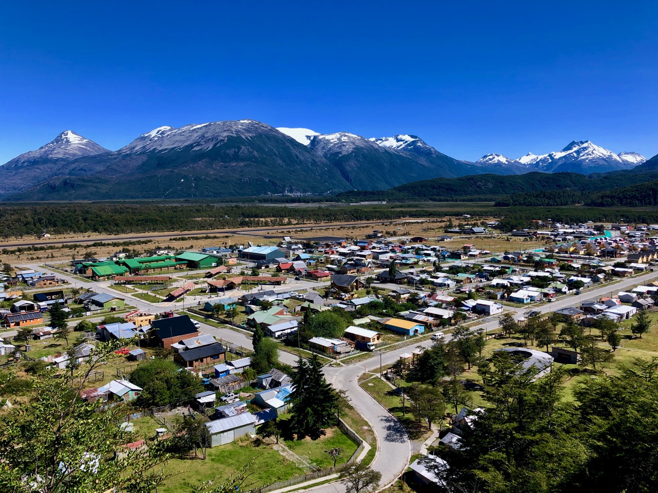
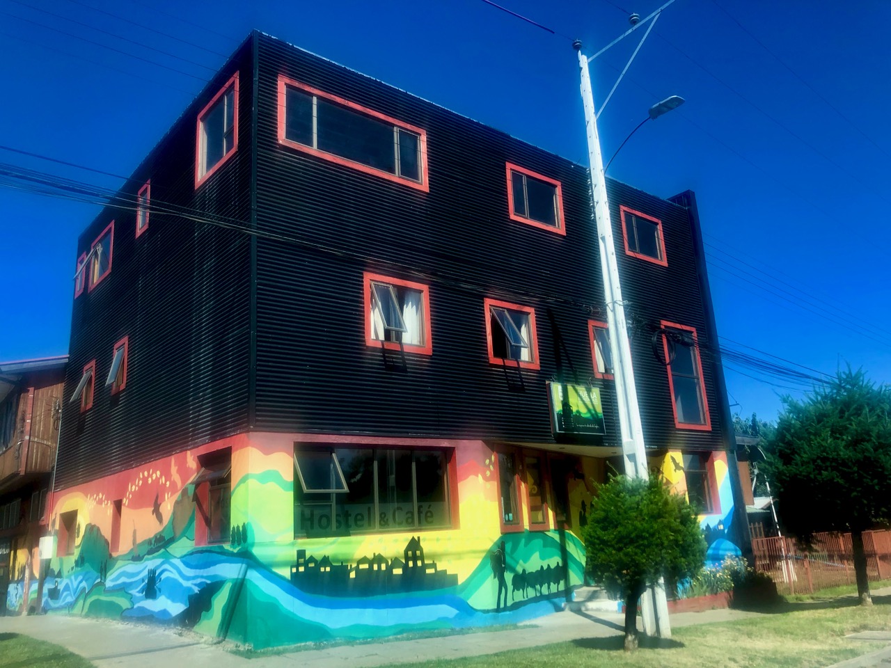
Still, I was thrilled to return to El Chaltén, one of my top 10 hiking towns in the world.

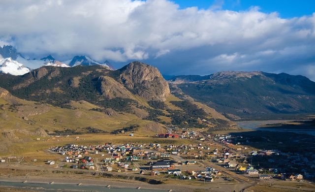
Chaltén’s changed a LOT since I was here 15 years ago. Back then it was a sleepy little dead end town. Now it’s party central on the backpacker circuit. My hostel has a restaurant open 24 hours a day!

Here’s the whole trip.

related – Stingy Nomads trip report

Villa O’Higgins, Chile – END of the dictator’s highway

If you head south to the end of the Carretera Austral … then take a ferry … you’ll eventually get to Villa O’Higgins.

This last bit of gravel road was completed in 2000.

We arrived at last light in perfect weather.

Not easy to reach, every tourist here is happy. I had a big grin on my face as I enjoyed dinner and wine at famed El Mosco campground and hostel.

Wind was quite light for Patagonia, but I tied down my tent quite securely anyway.

Next day I did two of three hikes out of town.

Like everywhere else on the CA this village is gearing up for MORE tourism in future.

Before tourists started arriving it was an agricultural community. One shopkeep told me it got VERY cold during winter. It’s surrounded by glaciers.

One thing I appreciate about Patagonia. The frequent lenticular cloud formations.

VERY cool Caleta Tortel, Chile

So weird and wonderful, it could be coastal Norway.

Caleta Tortel is a coastal village (founded 1955) in Chile. …

The surrounding geography is rugged, formed by a number of islands, fjords, channels and estuaries.

… the road was constructed only in 2003, and connects Caleta Tortel with the Carretera Austral.

Caleta Tortel consists mainly of stilt houses, typical of Chilotan architecture, built along the coast for several kilometers. There are no conventional streets – instead there are wooden walkways …

Since I hate motor vehicles, I loved Tortel.

I got there by bus from Cochrane.

Since my driver was a smoker, we had plenty of photo stops.

In Tortel, even the tent platforms are on stilts.

At the mouth of Chile’s largest river, we expected this to be a fishing village. Not so. It’s historically been a lumber town.

There two days, I spent plenty of time walking the boardwalk.

Cyclists all make the detour here.

A lovely place to visit.

NEW – Patagonia National Park, Chile

Patagonia National Parkannounced January 2018 — combined the Jeinimeni National Reserve (400,000 acres), the Tamango National Re􏰁serve (20,660 acres), and the privately􏰄-owned Patagonia Park (200,000 acres).

The part donated by Americans had been a sheep ranch.

Conservacion Patagonica, the organization founded by Kristine and the late Doug Tompkins of The North Face bought the the huge property in 2004 and had been returning it to natural state.

The sheep were sold but Gauchos offered work in the new Park.

Fences and invasive species were removed. Cows are long gone.

They donated it to the Chilean government.

I visited as part of a 6 hour tour out of Cochrane. Watching large numbers of guanacos running free was the highlight.

The Park Headquarters built by the Tompkins is first class, even better than Pumalin.

It includes a wonderful museum and library of essential conservation information.

I learned a lot.

Patagonia National Park should evolve to be the second best hiking destination on the Carretera Austral after Cerro Castillo.

Right now you still need private transportation to get to trailheads. No convenient hiker shuttle yet exists. IF only I still had a bike. 🙄

related – NY Times – With 10 Million Acres in Patagonia, a National Park System Is Born

Walking Patagonia by Caspian Ray

As I was headed for Patagonia I downloaded this eBook simply because of the title.

My review: A stupid traveler, bad writer.

Deeply flawed human being.

But for some reason his inane decisions and non-stop misadventures kept me going.

On the upside, he did meet his future wife on this trip.

kayaking the Marble Caves in Patagonia

On every list of the BEST tourist destinations in Chile are the Capilla de Marmol out of Puerto Río Tranquilo.

Click PLAY or watch it on YouTube.

I loved it.

This was my first stop after sending back my bike.

I got here by taking a the bus though increasingly open spaces heading south.

It’s all gravel past of Cerro Castillo. The best vehicles protect themselves.

Puerto Río Tranquilo is a tiny town (pop. 500) swamped by tourists in high season.

Río Tranquilo

All accommodation was booked by the time I got there so I walked out of town to lovely Pudu Campground. (Each campsite has a windbreak wall. This IS Patagonia.)

Locals are ready for serious rain.

This van is a rental from Wicked Campers. It looks to be the most popular way to drive the Carretera Austral.

It’s an incredible part of the world. Stunning views on to General Carrera Lake and beyond.

Almost everyone jumps into small boats to visit this weird and wonderful geology.

I’d been advised to go by kayak. And on the first tour in the morning. Therefore I was up before 6am getting coffee ready.

Surprisingly few sign up for kayaking. My group had 7 clients and 2 guides. It was very professional. (C$100)

I recommend it.

Following the trip I’d planned to hop a bus continuing south. But the road was closed for 4 hours due to forest fire.

We sat in the sun and watched helicopters trying to douse the flames.

Hurry up and wait happens in Patagonia.

Bikepacking Patagonia – days 21-23

My Bikepacking trip has ended after 23 days.

I shipped the rental back to Puerto Varas.

day 0 | 1 | 2 | 3 | 4 | 5/6 |7/8 | 9/10 | 11 | 12/13 | 14 | 15 | 16/17 | 18 | 19/20 | 21/23 end

Feb 3, 2019 – Coyhaique (0km)

Exhausted from my 120+km very hot day, like God I rested on Sunday.

There is one very good hostel here.

Got the laundry done. Bought shoelaces. Tried to get my Chilean phone service to continue working past the first month. (You have to register it with the police.)

When backpacking you have 1. clean clothes and … 5. filthy, wet, ammonia-reeking clothes … and about 3 categories in-between.

Nothing feels better than getting everything washed. 🙂

I did some planning for my life after cycling. I’ll continue to head south on the Carretera Austral.

Feb 4, 2019 – Coyhaique – wild camp (38km)

It was a scorching 33+C again … so I waited until 3:30pm before heading south.

This was the first day I was unenthusiastic to get going. And I was still tired from my last long ride.

A much less wild environment. But I still loved the more open scenery. A nice change from rugged mountains.

As you can see, autumn is coming.

On this ride I lost my old, trusty Elf camera. It was near end-of-life, in any case. From here on I’ll be carrying only my iPhone X camera and an old camcorder.

I set up what would end up to be my last bikepacking wild camp. Close to a little stream.

It was a another gorgeous, clear night.

Feb 5, 2019 – wild camp to Coyhaique (0km)

In no rush I enjoyed the morning at camp. Then packed up my steed for the run to Cerro Castillo. And further south.

Within the first km my chain jumped off 3 times from the rear wheel. (A cyclist later said problems with the spokes and thrown off the wheel alignment.)

It didn’t take me long to decide to end the trip.

As it happens, it’s easy to hitchhike anywhere if you have a broken bike.

An entertaining campground owner / caballero picked me up and drove me back to Coyhaique.

I had a bit of trouble finding the shipping company AGM. But they turned out to be very friendly and well organized. My cost to return bike and some other gear C$42.

After dropping the bike the Patagonian wind was like freedom. I felt terrific walking the 3km back to town.

The trip was excellent. I’d do it again for sure. Most of my distress came from worrying about mechanical issues with the bike. I’m terrible ☹️ at all things mechanical.

It was easier than I expected too. Things have improved since I last travelled the Carretera Austral 15 years ago. For one thing, free internet is easy to find.

So … here’s the map of the total trip. Perhaps 1400km when you count all the side trips.

I’ll be catching the bus south tomorrow. On the same roads that I would have cycled if I’d continued to the very end.

day 0 | 1 | 2 | 3 | 4 | 5/6 |7/8 | 9/10 | 11 | 12/13 | 14 | 15 | 16/17 | 18 | 19/20 | 21/23 end